
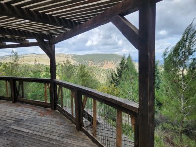
Viewpoint to Hermon mt. and Hula valley
Location: מועצה אזורית מבואות החרמון
GPS coordinates: 32.99885,35.51714
Latest update: November 12, 2025 05:13
Biria Fortress
1.3 km
Mount Canaan
2.3 km
Nabratein synagogue
775 m
Avi Vigder viewpoint
686 m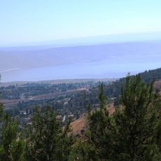
Liora Natelson View and rest point
1.6 km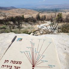
Mitzpe Chen
1.9 km
Shemurat Naẖal H̱aẕor
2.8 km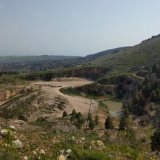
תצפית למפל
2.1 km
ספסלים
2.5 km
חורבת נבוריה
943 m
`Ammuqa
478 m
תצפית נחל דלתון
1 km
כפר פירעם
2.3 km
Scenic viewpoint
655 m
Scenic viewpoint
2.7 km
Scenic viewpoint
2.3 km
בוסתן נבוריה
756 m
מצפה אורי
1.4 km
Scenic viewpoint
1.2 km
Scenic viewpoint
575 m
Memorial
3 km
רבי יהודה בר עילאי
3 km
רבי קרוספדאי
3 km
רבי יוסי סראגוסי
3.1 km
קבר רבי יהודה בן תימא
3 km
עין זיתון
3.1 km
חירשת פטר לנדסמן 1989
2.2 km
Waterfall
2.4 kmReviews
Visited this place? Tap the stars to rate it and share your experience / photos with the community! Try now! You can cancel it anytime.
Discover hidden gems everywhere you go!
From secret cafés to breathtaking viewpoints, skip the crowded tourist spots and find places that match your style. Our app makes it easy with voice search, smart filtering, route optimization, and insider tips from travelers worldwide. Download now for the complete mobile experience.

A unique approach to discovering new places❞
— Le Figaro
All the places worth exploring❞
— France Info
A tailor-made excursion in just a few clicks❞
— 20 Minutes