תצפית מפל מיצר
Location: מועצה אזורית גולן
GPS coordinates: 32.73590,35.69543
Latest update: November 11, 2025 23:23

Turkish pilots memorial near Haon
5.9 km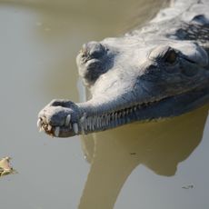
Crocodiles in Hamat Gader
5.7 km
תל סורג
5 km
Birket_Al_Arayes
3.6 km
H̱of Shezaf
5.9 km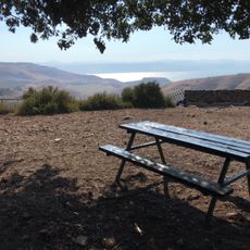
מחנה פיק
4.7 km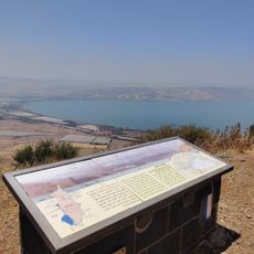
Mount Nemron Observation Deck
4.5 km
H̱of Shittim (lapyahan, lat 32,75, long 35,64)
5.9 km
Peace Lookout
4.3 km
Omri Tal viewpoint
3.7 km
Scenic viewpoint
978 m
الياقوس
5.8 km
Scenic viewpoint
4.5 km
Scenic viewpoint
5.4 km
Amphi Golan
3.8 km
Scenic viewpoint
3.6 km
Scenic viewpoint
4.1 km
תל חווארה
5.5 km
دبوسية
2.5 km
Scenic viewpoint
4.4 km
كفر حارب
4.3 km
رجم الياقوس
5.7 km
منطقة الزوية
5.3 km
عين كبريتية
1.9 km
خربة عيون
3.1 km
הטייסים התורכים
5.9 km
Baths
5.8 km
Archaeological site
5.8 kmReviews
Visited this place? Tap the stars to rate it and share your experience / photos with the community! Try now! You can cancel it anytime.
Discover hidden gems everywhere you go!
From secret cafés to breathtaking viewpoints, skip the crowded tourist spots and find places that match your style. Our app makes it easy with voice search, smart filtering, route optimization, and insider tips from travelers worldwide. Download now for the complete mobile experience.

A unique approach to discovering new places❞
— Le Figaro
All the places worth exploring❞
— France Info
A tailor-made excursion in just a few clicks❞
— 20 Minutes