
נוף הנשקף מסינגל חניתה בצידו המזרחי
Location: מועצה אזורית מטה אשר
Website: https://i.imgur.com/9eUibmC.jpg
GPS coordinates: 33.08023,35.17617
Latest update: October 24, 2025 18:53
Keshet Cave
1.5 km
Park Adamit
2.6 km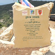
Mitzpeh Eitan
2.1 km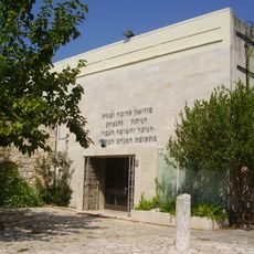
Hanita Wall and Tower Museum
891 m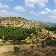
Tel Avdon
3.9 km
Wall and Tower
1 km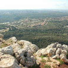
Ramat Adamit
2.6 km
Givat Hamudot
4.1 km
עולם הזוחלים של גולן
2.8 km
Mghâret et Toûn
3 km
Scenic viewpoint
1.8 km
דגם חומה ומגדל
1.1 km
באר חניתה הישנה
1.1 km
Namer Cave
1.4 km
גת
2.1 km
Scenic viewpoint
2.2 km
Scenic viewpoint
2.2 km
חורבת שרף
2.5 km
Scenic viewpoint
1.2 km
תל בד
1.7 km
אנדרטת רגב וגולדווסר
2 km
חורבת עובש
2.9 km
מצפור טופז
1.9 km
הכנסיה באל באסה
3.1 km
מסגד אל באסה
3.1 km
חורבת עין כובשים
922 m
חורבת כרכרה
4 km
במה
4 kmReviews
Visited this place? Tap the stars to rate it and share your experience / photos with the community! Try now! You can cancel it anytime.
Discover hidden gems everywhere you go!
From secret cafés to breathtaking viewpoints, skip the crowded tourist spots and find places that match your style. Our app makes it easy with voice search, smart filtering, route optimization, and insider tips from travelers worldwide. Download now for the complete mobile experience.

A unique approach to discovering new places❞
— Le Figaro
All the places worth exploring❞
— France Info
A tailor-made excursion in just a few clicks❞
— 20 Minutes