
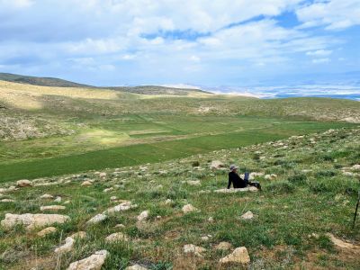
תצפית על עמק דליה
Location: שטח C
GPS coordinates: 31.99227,35.39621
Latest update: November 12, 2025 09:39
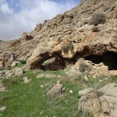
מערת הנמרים
6.4 km
Maghārat ad Dāliyah
407 m
Al Mughayyir
5.5 km
‘Irāq Ţayy
2.4 km
Maghārat Umm ‘Āwiyah
2 km
מיצפה כוכב
6.6 km
Sahl Hudhud
6.2 km
Maghārat Abū Shinjah
1.3 km
מצפה עם צל. ניתן להגיע עם הרכב דרך השביל הכחול
6.6 km
Maghārat Abū al ‘Iqbān
3.5 km
Maghārat Ra's at Tīn
3.8 km
Mughr Sa‘d
2.3 km
‘Irāq al Ghawārinah
4.1 km
‘Irāq an Na‘sānah
1.4 km
Maghārat al Mutabārikīyah
2.4 km
מגלשת עוג'ה
4.9 km
קטע קשה ומדורדר
3.5 km
Scenic viewpoint
5.8 km
Scenic viewpoint
1.9 km
Scenic viewpoint
4.2 km
Scenic viewpoint
5.4 km
קובת א נג'ימה
6.4 km
ח'ירבת אל-עוג'א
5.5 km
Ruins
5.8 km
טחונת אל פצאיל
6.8 km
Waterfall
6 km
מפל בנחל אל באקר
2.2 km
Waterfall
6.2 kmReviews
Visited this place? Tap the stars to rate it and share your experience / photos with the community! Try now! You can cancel it anytime.
Discover hidden gems everywhere you go!
From secret cafés to breathtaking viewpoints, skip the crowded tourist spots and find places that match your style. Our app makes it easy with voice search, smart filtering, route optimization, and insider tips from travelers worldwide. Download now for the complete mobile experience.

A unique approach to discovering new places❞
— Le Figaro
All the places worth exploring❞
— France Info
A tailor-made excursion in just a few clicks❞
— 20 Minutes