
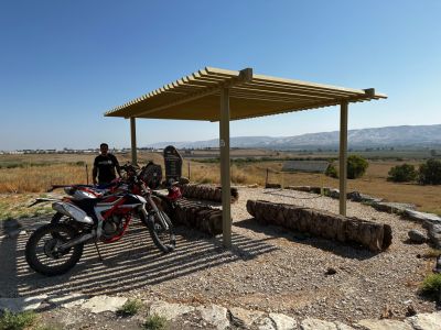
מצפור תל ישמעאל
Location: מועצה אזורית עמק המעיינות
GPS coordinates: 32.54933,35.55907
Latest update: October 24, 2025 18:55
Belvoir Fortress
6.2 km
Jordan River Crossing
6 km
Gesher
6 km
גשר שייח' חוסיין
6 km
Tel Zan
6.5 km
Tel Shoshan
6.2 km
חורבת גבול
5.2 km
Sharhabil Bin Hassneh EcoPark
6 km
Gan Le'ummi Kokav HaYarden
6.1 km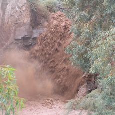
Qanyon HaBezzelet
6 km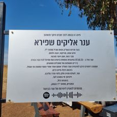
תצפית ענר שפירא
5.5 km
Environmental Sculpture
6.5 km
Shemurat Ge'on HaYarden - Ma‘oz H̱ayyim
4.9 km
Shemurat ‘En Ur
4.6 km
Shemurat Ge'on HaYarden - H̱amadya
3.9 km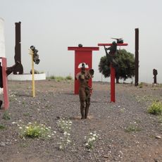
The Sculpture Garden of Belvoir
6.4 km
Shemurat Newé Ur
5.6 km
Shemurat Naẖal Yissakhar
4 km
ضريح عامر بن أبي وقاص
4.3 km
Scenic viewpoint
5.4 km
Waterfall
6 km
לזכרו של מאיר הר ציון
4.4 km
גשר של רכבת העמק
6.2 km
Waterfall
6 km
קבר מאיר הר ציון
5.4 km
Scenic viewpoint
6 km
מצפור שמעון יפרח
5.6 km
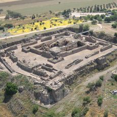
תל ישמעאל
717 mReviews
Visited this place? Tap the stars to rate it and share your experience / photos with the community! Try now! You can cancel it anytime.
Discover hidden gems everywhere you go!
From secret cafés to breathtaking viewpoints, skip the crowded tourist spots and find places that match your style. Our app makes it easy with voice search, smart filtering, route optimization, and insider tips from travelers worldwide. Download now for the complete mobile experience.

A unique approach to discovering new places❞
— Le Figaro
All the places worth exploring❞
— France Info
A tailor-made excursion in just a few clicks❞
— 20 Minutes