Scenic viewpoint

Log in to your account

AroundUs is a community-driven map of interesting places, built by curious explorers like you. It grows with every review, story, and photo you share.
Connect to save your favorite spots, contribute locations, and create personalized routes.
By continuing, you accept our Terms and Conditions and our Privacy Policy

Scenic viewpoint

GPS coordinates: 54.64311,-1.91942

Latest update: November 14, 2025 13:43

Around this place
Show the full map
Crag Gill
United Kingdom

Crag Gill

4.8 km
Low Redford Meadows
United Kingdom

Low Redford Meadows

4.4 km
Church of St John Evangelist
United Kingdom

Church of St John Evangelist

4 km
Podge Hole Bridge And Wall With Tail Race
United Kingdom

Podge Hole Bridge And Wall With Tail Race

4.1 km
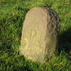
Boundary Stone Circa 400 Metres West Of Windy Nook
United Kingdom

Boundary Stone Circa 400 Metres West Of Windy Nook

2.7 km
The Grove Bridge Over Spurlswood Beck
United Kingdom

The Grove Bridge Over Spurlswood Beck

2.7 km
Penny Hill camp
United Kingdom

Penny Hill camp

4.9 km
Woodland War Memorial
United Kingdom

Woodland War Memorial

2 km
Boundary Stone On South Side Of Junction With Crane Row Lane
United Kingdom

Boundary Stone On South Side Of Junction With Crane Row Lane

4.2 km
Barn And Attached Loosebox To West Of Podgehole Mill
United Kingdom

Barn And Attached Loosebox To West Of Podgehole Mill

4 km
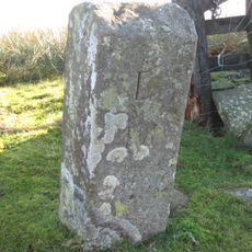
Boundary Stone
United Kingdom

Boundary Stone

3.7 km
Hollin Hill Farmhouse
United Kingdom

Hollin Hill Farmhouse

4.5 km
Milestone C.400 Metres East Of White House
United Kingdom

Milestone C.400 Metres East Of White House

4.5 km
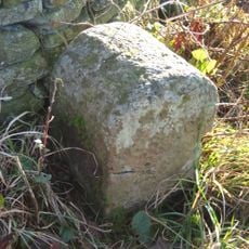
Boundary Stone
United Kingdom

Boundary Stone

2.3 km
Parish Boundary Stone C.100 Metres East Of Lead Mill House, On South Side Of Road
United Kingdom

Parish Boundary Stone C.100 Metres East Of Lead Mill House, On South Side Of Road

4.2 km
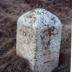
Milestone Circa 300 Metres East Of Junction With Billy Lane
United Kingdom

Milestone Circa 300 Metres East Of Junction With Billy Lane

3.4 km
Carved rock, cist and cairnfield 580m west of Hindon Edge
United Kingdom

Carved rock, cist and cairnfield 580m west of Hindon Edge

3.4 km
Podge Hole Mill House And Storage Building
United Kingdom

Podge Hole Mill House And Storage Building

4.1 km
Lead Mill House North Of Steel Gill
United Kingdom

Lead Mill House North Of Steel Gill

4.1 km
Frog Wood Bog
United Kingdom

Frog Wood Bog

3.3 km
Edge Hotel
United Kingdom

Edge Hotel

2.5 km
Smelt Mill Chimney
United Kingdom

Smelt Mill Chimney

4.2 km
Smith Tomb Of Circa 100 Metres West Of Church Of St John
United Kingdom

Smith Tomb Of Circa 100 Metres West Of Church Of St John

4 km
Green Man Life Cycle
United Kingdom

Green Man Life Cycle

4.4 km
Work of art, sculpture
United Kingdom

Work of art, sculpture

4.4 km
Scenic viewpoint
United Kingdom

Scenic viewpoint

3.3 km
Scenic viewpoint
United Kingdom

Scenic viewpoint

2 km
Blackling Hole waterfall
United Kingdom

Blackling Hole waterfall

19 m
Show the full map

Reviews

Visited this place? Tap the stars to rate it and share your experience / photos with the community! Try now! You can cancel it anytime.

« Scenic viewpoint » is provided by Around Us (aroundus.com). Images and texts are derived from Wikimedia project under a Creative Commons license. You are allowed to copy, distribute, and modify copies of this page, under the conditions set by the license, as long as this note is clearly visible.

Discover hidden gems everywhere you go!

From secret cafés to breathtaking viewpoints, skip the crowded tourist spots and find places that match your style. Our app makes it easy with voice search, smart filtering, route optimization, and insider tips from travelers worldwide. Download now for the complete mobile experience.

Around Us App Screenshot

A unique approach to discovering new places

Le Figaro

All the places worth exploring

France Info

A tailor-made excursion in just a few clicks

20 Minutes