
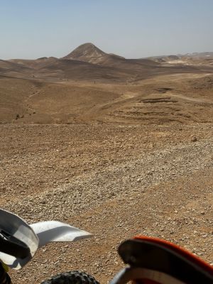
הר איתי
Location: מועצה אזורית תמר
GPS coordinates: 31.39062,35.29187
Latest update: November 11, 2025 23:56

Cave of Horror
6 km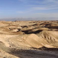
Scenic viewpoint
3.5 km
Me‘arot Hamatmon
3.5 km
Scenic viewpoint
5.3 km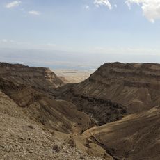
ראש מעלה נמר
3.6 km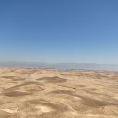
תצפית מראש הר חולד לכל המדבר
2.9 km
Scenic viewpoint
3.7 km
Scenic viewpoint
5.8 km
Scenic viewpoint
5.9 km
Scenic viewpoint
5.7 km
Scenic viewpoint
4.4 km
Scenic viewpoint
4 km
Scenic viewpoint
4.2 km
Scenic viewpoint
5.1 km
Scenic viewpoint
6 km
Scenic viewpoint
3.9 km
מאגורת ביר אשרקי
4.3 km
Scenic viewpoint
3.7 km
אורי סל-מן
3.7 km
משה שחר
5.9 km
Ruins
5.8 km
BAR SADE STRIP
4.7 km
הר חצרון
5.8 km
מעוז פניגשטיין
6 km
Waterfall
6 km
Waterfall
4.6 km
Waterfall
5.2 km
מפל נחל שפן
5.2 kmReviews
Visited this place? Tap the stars to rate it and share your experience / photos with the community! Try now! You can cancel it anytime.
Discover hidden gems everywhere you go!
From secret cafés to breathtaking viewpoints, skip the crowded tourist spots and find places that match your style. Our app makes it easy with voice search, smart filtering, route optimization, and insider tips from travelers worldwide. Download now for the complete mobile experience.

A unique approach to discovering new places❞
— Le Figaro
All the places worth exploring❞
— France Info
A tailor-made excursion in just a few clicks❞
— 20 Minutes