
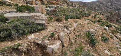
מבנה הרוס ברובו כחלק ממכלול לאורת פירמנוס.
Location: שטח C
GPS coordinates: 31.85671,35.28740
Latest update: December 1, 2025 02:33
Paran Monastery.
2.9 km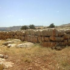
Qubur Bani Isra'il
2.4 km
Kh. ed-Dawwara
1.2 km
Maghārat Qabr al Bayn
2.7 km
Jaba‘
2.7 km
Tall Maryam
2.3 km
‘Irāq al Khudīsh
2.2 km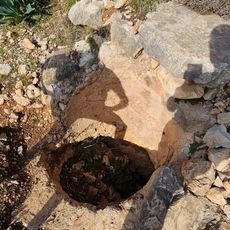
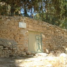
בור מים של לאורת חביבי. הפתח המסותת שלו נמצא במדרון מתחתיו כ-5 מטרים.
1.8 km
Maghārat ‘Irāq aḑ Ḑab‘
2.6 km
Jabal al Ḩulwah
3.2 km
Roman Houses
2.4 km
مقبرة أطفال
3.8 km
Scenic viewpoint
3.4 km
Scenic viewpoint
4.2 km
Scenic viewpoint
3.3 km
بيوت اثرية
3.8 km
مذبح
3.7 km
بيت مهجور
3.7 km
بئر
3.7 km
מצפה יהונתן
2 km
אמת מים
3.1 km
המפעל החקלאי
4.2 km
Archaeological site
4.1 km
Archaeological site
3.8 km
Archaeological site
3.7 km
Ruins
3.4 km
מתחם "חרבות גדעון" לזכר נופלי גדוד 13 גולני
1.4 km
Waterfall
2.6 kmReviews
Visited this place? Tap the stars to rate it and share your experience / photos with the community! Try now! You can cancel it anytime.
Discover hidden gems everywhere you go!
From secret cafés to breathtaking viewpoints, skip the crowded tourist spots and find places that match your style. Our app makes it easy with voice search, smart filtering, route optimization, and insider tips from travelers worldwide. Download now for the complete mobile experience.

A unique approach to discovering new places❞
— Le Figaro
All the places worth exploring❞
— France Info
A tailor-made excursion in just a few clicks❞
— 20 Minutes