
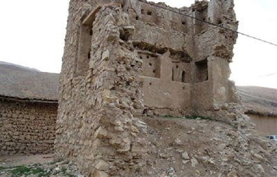
Khollar Tower, Iranian national heritage site
Location: Sepidan County
Website: https://seeiran.ir/wp-content/uploads/2017/09/%D8%AE%D9%84%D8%A7%D8%B1.jpg
GPS coordinates: 29.96514,52.23917
Latest update: November 12, 2025 18:06
Anshan Persia
17.1 km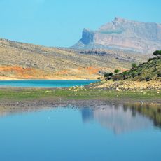
Dorudzan Dam
32 km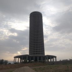
Fars Tower
30.1 km
Daryācheh-ye Sadd-e Dorūdzan
30.6 km
Relief of Bahram II at Guyim
21.5 km
Relief in Guyum
21.4 km
Ḩowẕ-e Berkeh
17.2 km
Āb Namā-ye Sīmānī
31.2 km
پاسگاه متروکه
502 m
شب شتری
17.4 km
باغ ارغوان شش پير
13.7 km
باغ نظريان دالين
14.2 km
مسجد متروکه
245 m
برج
380 m
مجتمع گردشگری تفریحی سرزمین سبز صدرا
30.9 km
سر چشمه
21.1 km
باغات حسین اباد
11.8 km
تنگ غوره دان
12.1 km
مجموعه گردشگری سرزمین آبی
29.4 km
تفرجگاه قلعه سنگی
29.5 km
Cyrus Ghahremani Circus
30.5 km
Pazz studio
29.8 km
Work of art
28.9 km
Work of art
25 km
Monument
137 m
آبشار قلات
19.5 km
آبشار دوم قلات
19.3 km
آبشار پاقلعه
21.7 kmReviews
Visited this place? Tap the stars to rate it and share your experience / photos with the community! Try now! You can cancel it anytime.
Discover hidden gems everywhere you go!
From secret cafés to breathtaking viewpoints, skip the crowded tourist spots and find places that match your style. Our app makes it easy with voice search, smart filtering, route optimization, and insider tips from travelers worldwide. Download now for the complete mobile experience.

A unique approach to discovering new places❞
— Le Figaro
All the places worth exploring❞
— France Info
A tailor-made excursion in just a few clicks❞
— 20 Minutes