Wayside cross
Location: Raabs an der Thaya
GPS coordinates: 48.83096,15.56731
Latest update: November 12, 2025 05:55

Burgruine Kollmitz
2.7 km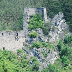
Burgruine Eibenstein
2 km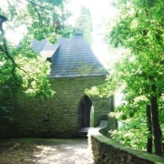
Klinger-Mausoleum
2.3 km
Böhmische Mauer
2.8 km
Pfarrkirche Eibenstein
1.7 km
Ortskapelle Hl. Dreifaltigkeit, Unterpfaffendorf
2.5 km
Ruine Kollmitz Raabs an der Thaya
2.7 km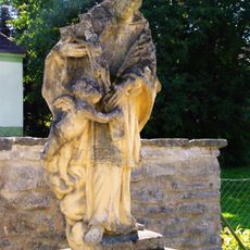
Figurenbildstock hl. Johannes Nepomuk, Unterpfaffendorf
2.5 km
Johannes-Nepomuk-Statue
2.3 km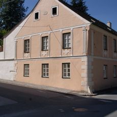
Eibenstein 10
1.9 km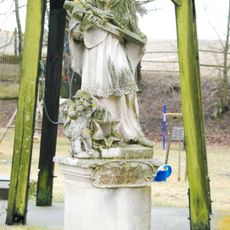
Johannes-Nepomuk-Statue
1.9 km
Pfarrhof
1.7 km
Schreckenstein
2.7 km
Uhufelsen
2.6 km
Scenic viewpoint
2.6 km
Scenic viewpoint
2.8 km
Scenic viewpoint
2 km
Scenic viewpoint
2.5 km
Mausoleum view
2.3 km
Scenic viewpoint
2.7 km
Fuchssprung
2.7 km
Wayside cross
2.7 km
Wayside cross, Christianity, Catholic church building
1.6 km
Motorrad Angel
1.5 km
Wayside shrine
2.7 km
Wayside cross
2.1 km
Wayside cross
1.5 km
Wayside shrine
2.3 kmReviews
Visited this place? Tap the stars to rate it and share your experience / photos with the community! Try now! You can cancel it anytime.
Discover hidden gems everywhere you go!
From secret cafés to breathtaking viewpoints, skip the crowded tourist spots and find places that match your style. Our app makes it easy with voice search, smart filtering, route optimization, and insider tips from travelers worldwide. Download now for the complete mobile experience.

A unique approach to discovering new places❞
— Le Figaro
All the places worth exploring❞
— France Info
A tailor-made excursion in just a few clicks❞
— 20 Minutes