Wayside shrine
Location: Krems an der Donau
GPS coordinates: 48.38292,15.64135
Latest update: November 14, 2025 00:38

Schloss Wolfsberg
889 m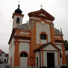
Pfarrkirche Brunnkirchen
746 m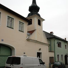
Ortskapelle
418 m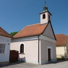
Ortskapelle
818 m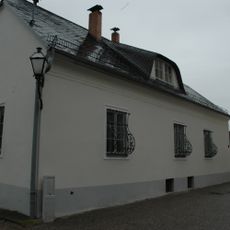
Pfarrhof
760 m
Bergwerkgedenkweg
858 m
Village chapel Angern
914 m
Scenic viewpoint
1.2 km
Scenic viewpoint
1.3 km
Hl. Barbara
1.6 km
Work of art, sculpture
1.5 km
Work of art, sculpture
460 m
Scenic viewpoint
1.2 km
Scenic viewpoint
1.4 km
Schaustollen Tiefenfucha
1.6 km
Scenic viewpoint
1.3 km
Scenic viewpoint
766 m
Scenic viewpoint
1.3 km
Warzenstein
1.1 km
Scenic viewpoint
1.5 km
Bildbirnbaumkreuz
1.6 km
Wayside shrine
898 m
Wayside cross
441 m
Erinnerung an das Bergwerk Thallern
508 m
Wayside shrine
1.3 km
Kriegerdenkmal
296 m
Wayside cross, Christianity, Catholic church building
1.6 km
Rotes Kreuz
1.2 kmReviews
Visited this place? Tap the stars to rate it and share your experience / photos with the community! Try now! You can cancel it anytime.
Discover hidden gems everywhere you go!
From secret cafés to breathtaking viewpoints, skip the crowded tourist spots and find places that match your style. Our app makes it easy with voice search, smart filtering, route optimization, and insider tips from travelers worldwide. Download now for the complete mobile experience.

A unique approach to discovering new places❞
— Le Figaro
All the places worth exploring❞
— France Info
A tailor-made excursion in just a few clicks❞
— 20 Minutes