Wayside shrine
Location: Bad Leonfelden
Inception: January 1, 1859
GPS coordinates: 48.51919,14.26806
Latest update: November 3, 2025 14:53
Joachimsquelle
1.1 km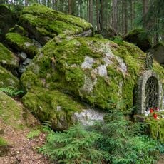
Lourdesgrotte
1.2 km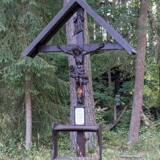
Ritterkreuz
986 m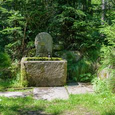
Wirterbrunnen
681 m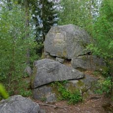
Felsensteig
1.1 km
Tastweg
883 m
Schmiedhütte
633 m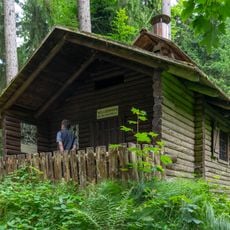
Holzfällerhütte
742 m
Holzhackerhütte
738 m
Blockmeer
1.1 km
Aussichtskanzel Moor
769 m
Kaiser Franz Josef Jubiläumsquelle
890 m
Moose und Algen
924 m
Sprunganlage
930 m
Pilzschau
975 m
Ritterkreuz
981 m
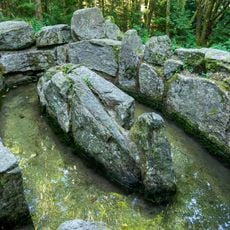
Kastners heilkräftiges Moorwasserbecken
731 m
Kohlenmeiler
1 km
Felixhöhe
1.1 km
Waldxylophon - Töne des Waldes
817 m
Wayside shrine, house of prayer, place of worship
727 m
Kneippsches Tretbecken
1.1 km
Wirterbrunnen
683 m
Lourdes Grotte
1.2 km
Wayside shrine, house of prayer, place of worship
578 m
Holzfuhrwerk
1.2 km
Fuchsg'schleif
1.2 km
Wildfütterung/Jagd
1.2 kmReviews
Visited this place? Tap the stars to rate it and share your experience / photos with the community! Try now! You can cancel it anytime.
Discover hidden gems everywhere you go!
From secret cafés to breathtaking viewpoints, skip the crowded tourist spots and find places that match your style. Our app makes it easy with voice search, smart filtering, route optimization, and insider tips from travelers worldwide. Download now for the complete mobile experience.

A unique approach to discovering new places❞
— Le Figaro
All the places worth exploring❞
— France Info
A tailor-made excursion in just a few clicks❞
— 20 Minutes