Schmaierlkreuz
Location: Munderfing
Inception: January 1, 1982
Inscription: "Schmaierl" Kürzester Übergang vom Katztal und Teufeltal;1982 wurde im Einvernehmen der österreichischen Bundesforste dieses Schmaierlkreuz vom Heimatverein Munderfing errichtet.
Made from material: wood
GPS coordinates: 48.06792,13.23391
Latest update: November 18, 2025 00:07

Pfarrkirche Munderfing
3.9 km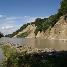
Salzach und Inn
1.4 km
Urzeitliche Befestigungsanlage Buchberg bei Heiligenstadt
3.3 km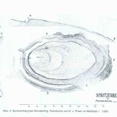
Ringwallanlage Spreitzenberg
3.1 km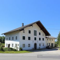
Mühlleutnermühle (Mühlendnermühle)/ Hauptgebäude
3.4 km
Wayside shrine
3.8 km
Matthias Reitshammer
3.4 km
Wayside shrine
3.4 km
Gemaltes Bild mit Gott Vater Jesus und Heiliger Geist
3.1 km
Martin Sporn
3.5 km
Armen Seelenkreuz
3.8 km
Franz Paschon
2.4 km
Weißenstein
2.2 km
Statue, memorial
3.8 km
Riesentanne
1 km
Franz Berrer
3.7 km
Historischer Prügelweg
1.1 km
Pestkreuz
2.9 km
Ignaz Wolsmar
2.3 km
Wayside cross, Christianity, Catholic church building
564 m
Catholic church building, wayside cross, Christianity
3.6 km
Holzkreuz mit Marienbild
2.4 km
Josef Schober
2.4 km
Peter Daxer
1.9 km
Kleine Tafel mit Jesus angebracht am Baum
3.8 km
Ignaz Jakob
2 km
St. Wolfgang
2 km
Josef Fuchs
1.6 kmReviews
Visited this place? Tap the stars to rate it and share your experience / photos with the community! Try now! You can cancel it anytime.
Discover hidden gems everywhere you go!
From secret cafés to breathtaking viewpoints, skip the crowded tourist spots and find places that match your style. Our app makes it easy with voice search, smart filtering, route optimization, and insider tips from travelers worldwide. Download now for the complete mobile experience.

A unique approach to discovering new places❞
— Le Figaro
All the places worth exploring❞
— France Info
A tailor-made excursion in just a few clicks❞
— 20 Minutes