Wayside cross
Location: Gnadendorf
Inscription: Hier verunglückte am 3. April 1933 Rudolf Lux. Herr gib ihm die ewige Ruhe!
GPS coordinates: 48.58652,16.33542
Latest update: November 3, 2025 20:01
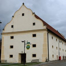
Schüttkasten
2.8 km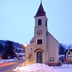
Ortskapelle Klement
2.9 km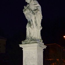
Statue of John of Nepomuk, Klement
2.9 km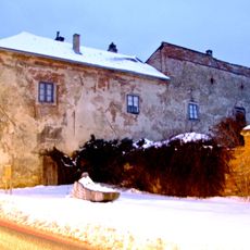
Schloss Klement
2.9 km
Hausberg Ödes Schloss
2.9 km
Krissl-Eiche
2.5 km
Wayside cross
2.7 km
Tree, Catholic church building, Christianity, tree shrine
2.2 km
Wayside cross
2.3 km
Wayside cross, Christianity
2.3 km
Wayside cross
2.3 km
Catholic church building, wayside cross, Christianity
2.4 km
Wayside shrine
2.5 km
Gärtnerkreuz
2 km
Wayside cross
2.6 km
Wayside shrine
2.6 km
Christianity, wayside cross
2.1 km
Catholic church building, wayside cross, Christianity
2.7 km
Wayside cross, Christianity
1.8 km
Bildeiche
2.8 km
Wayside shrine
2.8 km
Bildeiche
1.6 km
Wayside shrine
2.9 km
Fleischhackerkreuz
780 m
Ödes Schloss
2.9 km
Fischerkreuz
687 m
Wayside cross
416 m
Bildeiche
2.9 kmReviews
Visited this place? Tap the stars to rate it and share your experience / photos with the community! Try now! You can cancel it anytime.
Discover hidden gems everywhere you go!
From secret cafés to breathtaking viewpoints, skip the crowded tourist spots and find places that match your style. Our app makes it easy with voice search, smart filtering, route optimization, and insider tips from travelers worldwide. Download now for the complete mobile experience.

A unique approach to discovering new places❞
— Le Figaro
All the places worth exploring❞
— France Info
A tailor-made excursion in just a few clicks❞
— 20 Minutes