Tree, wayside shrine
Location: Rappottenstein
Website: https://zcrux.zwalk.at/bildbaum-48-514140-15-085590
GPS coordinates: 48.51411,15.08564
Latest update: November 12, 2025 18:20

Rappottenstein Castle
351 m
Pfarrkirche Rappottenstein
915 m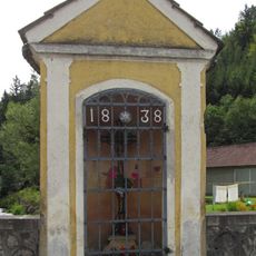
Straßenbrücke und Wegkapelle
303 m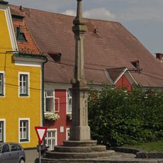
Pranger
934 m
Pillory, Listed objects in Austria, whipping post
934 m
Pfarrhof
952 m
Memorial cross, memorial
1.3 km
Wayside shrine
782 m
Rock, rock, wayside shrine
1.1 km
Wayside shrine, Christianity
807 m
Wayside shrine, Christianity
998 m
Verf. Hof
1.4 km
Dungler Kapelle
743 m
Wayside cross
413 m
Scenic viewpoint
638 m
Wayside cross
1.4 km
Christianity, wayside shrine
1.3 km
Burgblick
739 m
Wayside cross
713 m
Christianity, wayside shrine
525 m
Wayside cross
1.1 km
Hl. Antonius
315 m
Schwarzes Kreuz
1.1 km
Friedhofskreuz
821 m
Christianity, wayside shrine
892 m
Rock, wayside shrine, rock
1.5 km
Sonnwendfeuer
904 m
Scenic viewpoint
1.6 kmReviews
Visited this place? Tap the stars to rate it and share your experience / photos with the community! Try now! You can cancel it anytime.
Discover hidden gems everywhere you go!
From secret cafés to breathtaking viewpoints, skip the crowded tourist spots and find places that match your style. Our app makes it easy with voice search, smart filtering, route optimization, and insider tips from travelers worldwide. Download now for the complete mobile experience.

A unique approach to discovering new places❞
— Le Figaro
All the places worth exploring❞
— France Info
A tailor-made excursion in just a few clicks❞
— 20 Minutes