Cannon
Location: Ramillies-Offus
Location: Ramillies
GPS coordinates: 50.63643,4.91538
Latest update: November 14, 2025 07:48
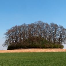
Tumulus of Hottomont
2.3 km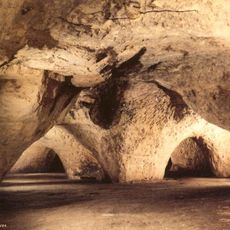
Caves of Folx-les-Caves
4 km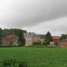
Boneffe Abbey
3.4 km
Château de Bolinne-Harlue
2.2 km
Église Saint-Martin, Harlue-Bolinne
3.1 km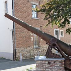
Canon 1918
3.1 km
Pour la Patrie
3.2 km
Wayside shrine, Christianity, Catholic church building
3.5 km
Scenic viewpoint
4.4 km
Christianity, Catholic church building, wayside shrine
5.5 km
A nos héros
3.1 km
Colon le brigand
3.1 km
Morts pour la Patrie
3 m
Chapelle de Sainte Émerance
3.3 km
Refuge Contemplatif
3.5 km
Catholic church building, wayside shrine, Christianity
5.6 km
Memorial
5.1 km
Chapelle Sainte-Marie
2.9 km
Catholic church building, wayside shrine, Christianity
3.7 km
Catholic church building, wayside shrine, Christianity
2.1 km
Christianity, Catholic church building, wayside shrine
2.6 km
Wayside shrine, Christianity, Catholic church building
4.5 km
Memorial
3.6 km
Potalle
2.6 km
Catholic church building, Christianity
3.9 km
Wayside shrine, Christianity, Catholic church building
1.5 km
Aux morts
4.6 km
Water well
4.2 kmReviews
Visited this place? Tap the stars to rate it and share your experience / photos with the community! Try now! You can cancel it anytime.
Discover hidden gems everywhere you go!
From secret cafés to breathtaking viewpoints, skip the crowded tourist spots and find places that match your style. Our app makes it easy with voice search, smart filtering, route optimization, and insider tips from travelers worldwide. Download now for the complete mobile experience.

A unique approach to discovering new places❞
— Le Figaro
All the places worth exploring❞
— France Info
A tailor-made excursion in just a few clicks❞
— 20 Minutes