Wayside shrine
Location: Hradec nad Moravicí
GPS coordinates: 49.86619,17.87538
Latest update: November 3, 2025 15:16

Hradec nad Moravicí Castle
257 m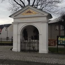
Chapel of Saint John of Nepomuk (Hradec nad Moravicí)
525 m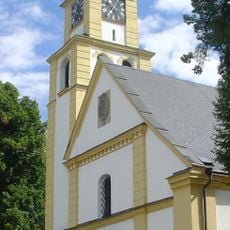
Church of Saints Peter and Paul
33 m
Slovanské hradiště, osada lidu kultury s kanel. keramikou a popelnicových polí
73 m
Socha Panny Marie v Hradci nad Moravicí u kostela svatého Petra a Pavla
25 m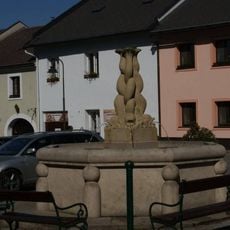
Kašna na náměstí před zámkem v Hradci nad Moravicí
83 m
Cannon
263 m
St. III
355 m
Pivovarské sklepy
230 m
Scenic viewpoint
255 m
Ludwig van Beethoven
113 m
Socha u pivovarských sklepů
259 m
Cannon
261 m
Catholic church building, wayside cross, Christianity
28 m
Pochody Smrti
285 m
Scenic viewpoint
328 m
Kaplička u Pivovarská
355 m
Scenic viewpoint
129 m
St. II
373 m
St. IV
376 m
St. I
381 m
Statue, Work of art
395 m
St. V
421 m
Kaplička
424 m
Koupaliště Hradec nad Moravicí
446 m
St. VI
480 m
Scenic viewpoint
510 m
Vesmírný znak
514 mReviews
Visited this place? Tap the stars to rate it and share your experience / photos with the community! Try now! You can cancel it anytime.
Discover hidden gems everywhere you go!
From secret cafés to breathtaking viewpoints, skip the crowded tourist spots and find places that match your style. Our app makes it easy with voice search, smart filtering, route optimization, and insider tips from travelers worldwide. Download now for the complete mobile experience.

A unique approach to discovering new places❞
— Le Figaro
All the places worth exploring❞
— France Info
A tailor-made excursion in just a few clicks❞
— 20 Minutes