Wayside shrine
Location: Saint-Germier
Inscription: St Roch
GPS coordinates: 43.66641,0.95018
Latest update: November 3, 2025 14:16
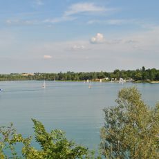
Lac de Thoux St-Cricq
5.1 km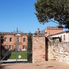
Château de Razengues
4.7 km
Église Sainte-Quitterie d'Escornebœuf
3 km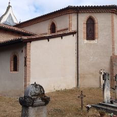
Église Notre-Dame-de-la-Nativité de Razengues
4.9 km
Memorial
3.9 km
Statue de la Vierge Marie
4.1 km
Monument aux Morts
3 km
Wayside shrine
3 km
Catholic church building, wayside cross
2.8 km
Wayside cross
3.1 km
Wayside cross
3.7 km
Wayside cross
3.8 km
Wayside cross
3.9 km
Catholic church building, wayside cross
2.6 km
Memorial, war memorial
3.9 km
Wayside cross
4 km
Catholic church building, wayside cross
4.1 km
Catholic church building, wayside cross
2.8 km
Wayside cross
4.1 km
Catholic church building, wayside cross
4.6 km
Château
98 m
Wayside cross
4.7 km
Ruins, lavoir
4.8 km
Catholic church building, wayside cross
4.9 km
Catholic church building, wayside cross
60 m
Catholic church building, wayside cross
5 km
Monument aux Morts
56 mReviews
Visited this place? Tap the stars to rate it and share your experience / photos with the community! Try now! You can cancel it anytime.
Discover hidden gems everywhere you go!
From secret cafés to breathtaking viewpoints, skip the crowded tourist spots and find places that match your style. Our app makes it easy with voice search, smart filtering, route optimization, and insider tips from travelers worldwide. Download now for the complete mobile experience.

A unique approach to discovering new places❞
— Le Figaro
All the places worth exploring❞
— France Info
A tailor-made excursion in just a few clicks❞
— 20 Minutes