Wayside cross
Location: Saint-Pierre-de-Clairac
Inception: January 1, 1879
GPS coordinates: 44.17958,0.76060
Latest update: November 12, 2025 18:44

Manoir de Prades
4.4 km
Monastery of Sainte-Marie de la Garde
2.6 km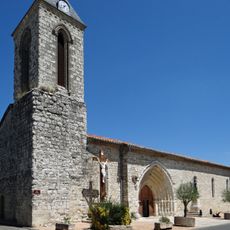
Église Notre-Dame du Grand-Castel
3 km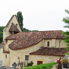
Église Notre-Dame de Cabalsaut
2 km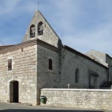
Église Saint-Caprais de Saint-Caprais-de-Lerm
4 km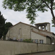
Église Saint-Romain de Saint-Romain-le-Noble
2.8 km
Remparts de Puymirol
3 km
Windmill of Laclotte
4.4 km
Château de Pech-Redon
3.7 km
Maison, rue Royale
2.9 km
Memorial
3 km
Ruins
1.7 km
Wayside cross
2.7 km
Wayside cross
3 km
Château de la Sévelotte
2.2 km
Monument Armand Casse
3.3 km
Memorial, war memorial
4 km
Wayside cross
3.2 km
Monument aux Morts
3.2 km
7 juin 1944
203 m
Ruins
3.8 km
Ruins
3.8 km
Ruins
3.5 km
Ruins
3.8 km
Ruins
3.2 km
War memorial, memorial
3.4 km
Ruins
4.4 km
Catholic church building, wayside cross
4.2 kmReviews
Visited this place? Tap the stars to rate it and share your experience / photos with the community! Try now! You can cancel it anytime.
Discover hidden gems everywhere you go!
From secret cafés to breathtaking viewpoints, skip the crowded tourist spots and find places that match your style. Our app makes it easy with voice search, smart filtering, route optimization, and insider tips from travelers worldwide. Download now for the complete mobile experience.

A unique approach to discovering new places❞
— Le Figaro
All the places worth exploring❞
— France Info
A tailor-made excursion in just a few clicks❞
— 20 Minutes