Catholic church building, wayside cross
Location: Saint-Rome-de-Tarn
GPS coordinates: 44.04718,2.90057
Latest update: November 20, 2025 01:10
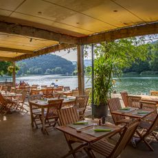
Saint-Rome Plage
1.1 km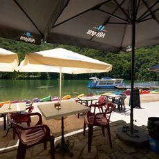
Plage de La Nauq
2.8 km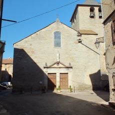
Église Saint-Romain de Saint-Rome-de-Tarn
353 m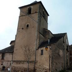
Église Saint-Saturnin de Viala-du-Tarn
3.2 km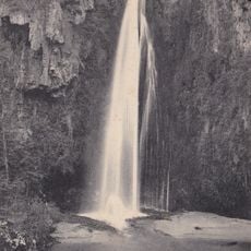
Cascade des Baumes
672 m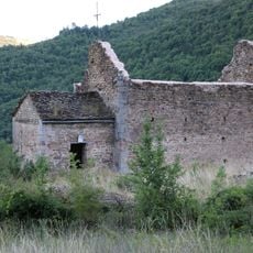
Église Saint-Martin d'Ayguebonne
3.2 km
Chapelle Saint-Jacques du Minier
3.2 km
Dolmen de Concoules 4
3 km
Maison, le Minier
3.2 km
Dolmen d'Auriac
870 m
Dolmen de Concoules 5
2.8 km
Dolmen de Concoules 6
2.8 km
Dolmen de Concoules 3
3.1 km
Dolmen de Concoules 2
3 km
Scenic viewpoint
2.9 km
Scenic viewpoint
2 km
Wayside cross
3.3 km
Memorial, war memorial
298 m
Catholic church building, wayside cross
2.9 km
Château d'Auriac
845 m
Wayside cross
3.3 km
Wayside cross
602 m
Memorial
309 m
Wayside cross
307 m
Denis Auguste Affre
416 m
La Pierre Noire
461 m
Cascade de la Baume
678 m
Waterfall
467 mVisited this place? Tap the stars to rate it and share your experience / photos with the community! Try now! You can cancel it anytime.
Discover hidden gems everywhere you go!
From secret cafés to breathtaking viewpoints, skip the crowded tourist spots and find places that match your style. Our app makes it easy with voice search, smart filtering, route optimization, and insider tips from travelers worldwide. Download now for the complete mobile experience.

A unique approach to discovering new places❞
— Le Figaro
All the places worth exploring❞
— France Info
A tailor-made excursion in just a few clicks❞
— 20 Minutes