High water mark
Location: Entraygues-sur-Truyère
GPS coordinates: 44.64562,2.56406
Latest update: November 6, 2025 18:56
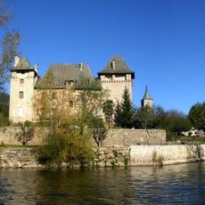
Château d'Entraygues
168 m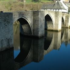
Pont sur la Truyère
501 m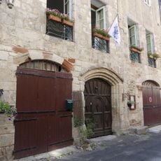
Maison Valette
121 m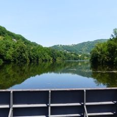
Lac de Cambeyrac
1.7 km
Église Saint-Georges d'Entraygues-sur-Truyère
75 m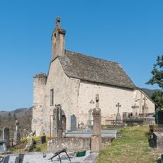
Chapelle Saint-Georges d'Entraygues-sur-Truyère
506 m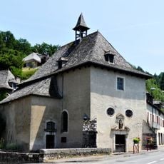
Chapelle Notre-Dame-du-Pontet
663 m
Scenic viewpoint
260 m
Scenic viewpoint
969 m
Scenic viewpoint
941 m
Scenic viewpoint
370 m
Wayside cross
897 m
Wayside cross
1.8 km
Wayside cross
631 m
Wayside cross
318 m
Wayside cross
265 m
Memorial, war memorial
971 m
Wayside cross
1.1 km
Memorial, commemorative plaque
102 m
Wayside cross
1.8 km
Wayside cross
741 m
Wayside cross
1.9 km
War memorial, memorial
1.9 km
Wayside cross
1.9 km
Wayside cross
2 km
Wayside cross
2 km
Wayside cross
2 km
Wayside cross
2.1 kmReviews
Visited this place? Tap the stars to rate it and share your experience / photos with the community! Try now! You can cancel it anytime.
Discover hidden gems everywhere you go!
From secret cafés to breathtaking viewpoints, skip the crowded tourist spots and find places that match your style. Our app makes it easy with voice search, smart filtering, route optimization, and insider tips from travelers worldwide. Download now for the complete mobile experience.

A unique approach to discovering new places❞
— Le Figaro
All the places worth exploring❞
— France Info
A tailor-made excursion in just a few clicks❞
— 20 Minutes