Wayside shrine
Location: Saint-Montan
Subject:
GPS coordinates: 44.44033,4.62259
Latest update: November 13, 2025 21:09
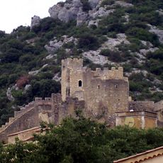
Castle of Saint-Montan
86 m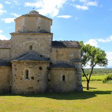
Église Saint-Pierre
2.1 km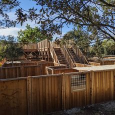
Mad Maze
3.2 km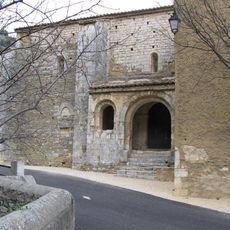
San Samonta church in Saint-Montan
306 m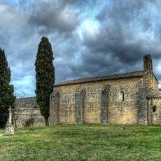
Chapelle Saint-André de Mitroys
1.1 km
Église Sainte-Marie-Madeleine de Saint-Montan
66 m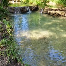
Cascade d'Imbours
2.6 km
Scenic viewpoint
1.8 km
Scenic viewpoint
132 m
Scenic viewpoint
1.8 km
Château de Saint-Montan
470 m
Porte du Cez
92 m
Scenic viewpoint
2 km
Scenic viewpoint
71 m
Bureau d'Information Touristique de Larnas
2.2 km
Catholic church building, wayside cross
2.1 km
Catholic church building, wayside cross
113 m
Wayside cross
2.5 km
Porte du Tour
59 m
Wayside cross
2.1 km
Porte de Clastre
126 m
Wayside cross
105 m
Wayside cross
71 m
Tour du Marin
42 m
Wayside cross
2.6 km
Wayside cross
308 m
Cascade du Ranc Cabiar
2.5 km
Waterfall
2.6 kmReviews
Visited this place? Tap the stars to rate it and share your experience / photos with the community! Try now! You can cancel it anytime.
Discover hidden gems everywhere you go!
From secret cafés to breathtaking viewpoints, skip the crowded tourist spots and find places that match your style. Our app makes it easy with voice search, smart filtering, route optimization, and insider tips from travelers worldwide. Download now for the complete mobile experience.

A unique approach to discovering new places❞
— Le Figaro
All the places worth exploring❞
— France Info
A tailor-made excursion in just a few clicks❞
— 20 Minutes