Wayside shrine
Location: Pleckensteiner Wald
GPS coordinates: 48.76183,13.81799
Latest update: November 12, 2025 19:01
Bayerischer Plöckenstein
1.3 km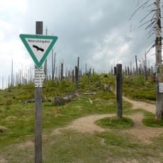
Hochwald
1.1 km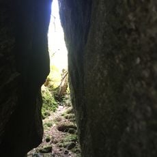
Putzniglluckn
1.1 km
Katholische Kapelle Maria Hilf
1.3 km
Kapelle
1.5 km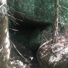
Labyrinthhöhle
1.2 km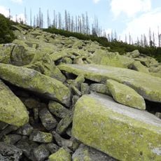
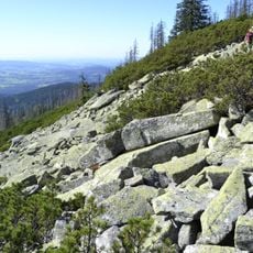
Steinernes Meer am Plöckenstein
1.2 km
Haus der Böhmerwäldler / Adolf-Webinger-Haus
1.3 km
Stifter und der Wald - Museum im Rosenberger Gut
1.1 km
Rosenberger Gut, Adalbert-Stifter-Museum
1.1 km
Hofmauer Lackenhäuser 146 in Neureichenau
1.1 km
Nebengebäude Lackenhäuser 146 in Neureichenau
1.1 km
Nebengebäude Lackenhäuser 146 in Neureichenau
1.1 km
Markscheide
1.4 km
Reh-Silhouette
1.3 km
Luchs-Silhouette
1.2 km
Zwei Köpfe, zwei Steine
838 m
Scenic viewpoint
1.2 km
Scenic viewpoint
1.3 km
Scenic viewpoint
1.4 km
Scenic viewpoint
1.2 km
Scenic viewpoint
1.2 km
Scenic viewpoint
1.2 km
Böhmerwald-Denkmal
769 m
Wayside shrine
1 km
Memorial, war memorial
812 m
Memorial, commemorative plaque
756 m
Catholic church building, wayside cross, Christianity
158 mReviews
Visited this place? Tap the stars to rate it and share your experience / photos with the community! Try now! You can cancel it anytime.
Discover hidden gems everywhere you go!
From secret cafés to breathtaking viewpoints, skip the crowded tourist spots and find places that match your style. Our app makes it easy with voice search, smart filtering, route optimization, and insider tips from travelers worldwide. Download now for the complete mobile experience.

A unique approach to discovering new places❞
— Le Figaro
All the places worth exploring❞
— France Info
A tailor-made excursion in just a few clicks❞
— 20 Minutes