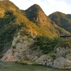
Wollyubong
9.5 km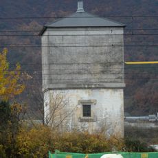
Water Tower at Chupungnyeong Station, Yeongdong
11.8 km
영동 반야사 삼층석탑
3.7 km
Dodeokbong (tumoy sa bukid sa Habagatang Korea, lat 36,37, long 127,80)
14.1 km
Chobong
14.4 km
Chuhaeng-bong
5.3 km
Kuksu-bong (tumoy sa bukid sa Habagatang Korea, Gyeongsangbuk-do)
11.5 km
Baksambong
8.3 km
Maebong (tumoy sa bukid sa Habagatang Korea, Chungcheongbuk-do, lat 36,29, long 127,84)
9.2 km
Gulbong (tumoy sa bukid sa Habagatang Korea, lat 36,21, long 127,87)
12.4 km
Gulbong (tumoy sa bukid sa Habagatang Korea, lat 36,21, long 127,85)
13.3 km
Gamtubong (tumoy sa bukid sa Habagatang Korea, Chungcheongbuk-do, lat 36,20, long 127,95)
12.1 km
Siru-bong
13.2 km
Hwangsaebong
13 km
Gwanbong (tumoy sa bukid sa Habagatang Korea, lat 36,29, long 127,78)
14.2 km
Cheomabong
6.9 km
Baekhwabong
12.8 km
T'ugu-bong (tumoy sa bukid sa Habagatang Korea, Gyeongsangbuk-do)
10.2 km
Sangp'an-je
7 km
Blue One Sangju Golf Resort
3.2 km
New Springville II Golf & Resort Country Club (Baekhwasan)
6.3 km
Trailhead long hike to Jikjisa
12.6 km
Scenic viewpoint
12.7 km
효자정재수기념관
12.3 km
노근리 쌍굴다리
11.3 km
Monument
12.5 km
수봉재 표지석
3.2 km
서울부산간고속도로 준공기념탑
13.2 kmReviews
Visited this place? Tap the stars to rate it and share your experience / photos with the community! Try now! You can cancel it anytime.
Discover hidden gems everywhere you go!
From secret cafés to breathtaking viewpoints, skip the crowded tourist spots and find places that match your style. Our app makes it easy with voice search, smart filtering, route optimization, and insider tips from travelers worldwide. Download now for the complete mobile experience.

A unique approach to discovering new places❞
— Le Figaro
All the places worth exploring❞
— France Info
A tailor-made excursion in just a few clicks❞
— 20 Minutes