
Důl Theodor, منجم في التشيك
Location: Svatoslav
Inception: 1862
GPS coordinates: 49.30250,16.30366
Latest update: November 14, 2025 10:35
Church of Saints Peter and Paul
2.9 km
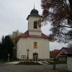
Church of the Assumption of the Virgin Mary (Svatoslav)
338 m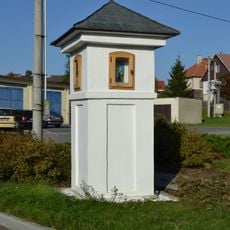
Boží muka
3.1 km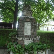
Pomník padlým ve světových válkách
3 km
Pomník posledního mlynáře Ve Žlebě
2.9 km
Myslivna
2.2 km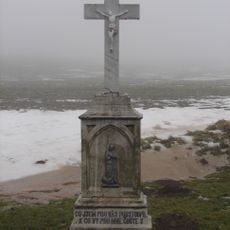
Kříž
3 km
Deblínská lesnická naučná stezka
2.1 km
Wayside cross
1.8 km
Wayside cross
878 m
Scenic viewpoint
3 km
Scenic viewpoint
2.4 km
Wayside shrine
649 m
Wayside cross
1.7 km
Statue, Work of art
1.9 km
Wayside cross
3 km
František Absolín
3 km
Statue, Work of art
1.9 km
Wayside cross
713 m
Wayside cross
1.1 km
Wayside cross, Christianity, Catholic church building
2.1 km
Catholic church building, wayside cross, Christianity
1.4 km
Memorial
3 km
Wayside cross
2.1 km
Wayside shrine
929 m
Wayside shrine
3.1 km
Wayside cross
2.2 km
Waterfall
2.5 kmReviews
Visited this place? Tap the stars to rate it and share your experience / photos with the community! Try now! You can cancel it anytime.
Discover hidden gems everywhere you go!
From secret cafés to breathtaking viewpoints, skip the crowded tourist spots and find places that match your style. Our app makes it easy with voice search, smart filtering, route optimization, and insider tips from travelers worldwide. Download now for the complete mobile experience.

A unique approach to discovering new places❞
— Le Figaro
All the places worth exploring❞
— France Info
A tailor-made excursion in just a few clicks❞
— 20 Minutes