
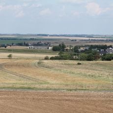
OP-S 37 U olší, pěchotní srub u Sádku
Location: Sádek
Part of: Fortification subsection 3./IV. Milostovice
GPS coordinates: 49.96115,17.75591
Latest update: November 14, 2025 07:59
Šibenice
1.7 km
Church of the Assumption of the Virgin Mary
1.1 km
Kaple
956 m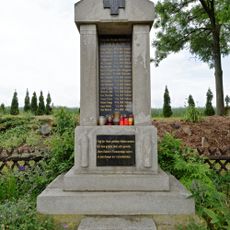
Pomník padlým v Sádku u Opavy
925 m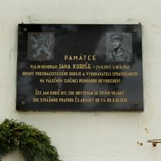
Pamětní deska Jana Kubiše v Sádku u Opavy
1 km
OP-S 38 U pomníku
761 m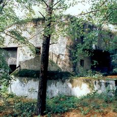
OP-S 36a Dvoják horní casemate
737 m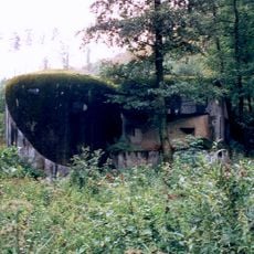
OP-S 36b Dvoják dolní casemate
686 m
IV/931/A-160
878 m
IV/932/A-120
1.6 km
IV/933/B2-90 lom
930 m
IV/934/D1
1.1 km
V/1007/A-160
226 m
V/1047/B2-80 Z
543 m
V/939/B1-90
718 m
V/940/A-140 Z
240 m
V/941/B2-100
400 m
V/942/A-140
352 m
V/944/D2
534 m
V/945/A-180 Z
451 m
V/946/B2-80
740 m
V/947/A-160
848 m
V/948/B2-100
704 m
V/949/A-160 Z
1.1 km
V/950/A-120
1.2 km
V/951/A-140
1.4 km
V/953/A-140 Z
1.6 km
V/956/A-120
586 mReviews
Visited this place? Tap the stars to rate it and share your experience / photos with the community! Try now! You can cancel it anytime.
Discover hidden gems everywhere you go!
From secret cafés to breathtaking viewpoints, skip the crowded tourist spots and find places that match your style. Our app makes it easy with voice search, smart filtering, route optimization, and insider tips from travelers worldwide. Download now for the complete mobile experience.

A unique approach to discovering new places❞
— Le Figaro
All the places worth exploring❞
— France Info
A tailor-made excursion in just a few clicks❞
— 20 Minutes