
Ringkrans, cliff in Northern Cape, South Africa
Location: Northern Cape
Elevation above the sea: 1,386 m
GPS coordinates: -32.67056,20.71028
Latest update: March 28, 2025 03:16

Cango Caves
161.8 km
Southern African Large Telescope
34.1 km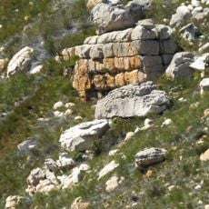
Cederberg
157.3 km
Swartberg
171.9 km
Tankwa Karoo National Park
101.6 km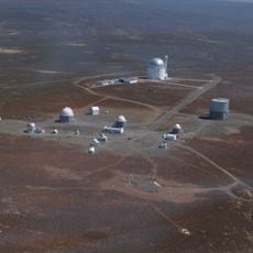
South African Astronomical Observatory
250.9 km
Cango Wildlife Ranch
172 km
Beaufort West Reformed Church
179.4 km
CP Nel Museum
172.8 km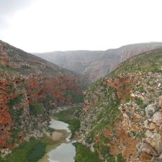
Buffelspoort
87.4 km
Karoo Desert National Botanical Garden
157.7 km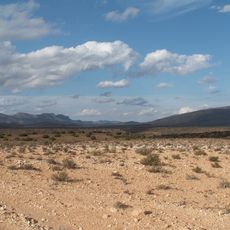
Anysberg Nature Reserve
94.6 km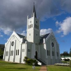
Nederduits Gereformeerde Kerk
137.2 km
Marloth Nature Reserve
146.8 km
Gamkaberg Nature Reserve
140.4 km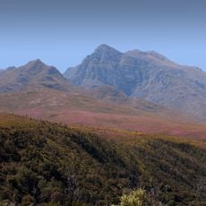
Boosmansbos Wilderness Area
141.4 km
Roggeveld
52.4 km
Swartberg Nature Reserve
142.8 km
Ceres Transport Riders’ Museum
155.5 km
Dutch Reformed Church, Montagu
135.9 km
Church of St James the Great, Worcester
160.3 km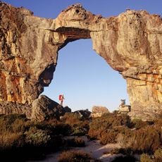
Cederberg Wilderness Area
154.2 km
Sneeuberg
150 km
Stadsaal Caves
131.7 km
Drostdy Museum
151.9 km
Fynbos Guest Farm
162.5 km
Njalo-Njalo Safaris
102.9 km
Voëlvlei Reservoir
173.9 kmReviews
Visited this place? Tap the stars to rate it and share your experience / photos with the community! Try now! You can cancel it anytime.
Discover hidden gems everywhere you go!
From secret cafés to breathtaking viewpoints, skip the crowded tourist spots and find places that match your style. Our app makes it easy with voice search, smart filtering, route optimization, and insider tips from travelers worldwide. Download now for the complete mobile experience.

A unique approach to discovering new places❞
— Le Figaro
All the places worth exploring❞
— France Info
A tailor-made excursion in just a few clicks❞
— 20 Minutes