Guru Agung, village in Rejang Lebong Regency, Bengkulu, Indonesia
Location: Padang Ulak Tanding
GPS coordinates: -3.39100,102.82500
Latest update: March 6, 2025 09:34
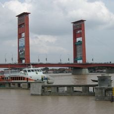
Ampera Bridge
219.9 km
Dempo
77.2 km
Kerinci Seblat National Park
184.4 km
Lake Ranau
205.2 km
Fort Marlborough
77.6 km
Bung Karno Seclusion House
77.4 km
Muhammad Cheng Hoo Mosque
220.9 km
Tropical Rainforest Heritage of Sumatra
177.6 km
Great Mosque of Palembang
219.7 km
Prasasti Karang Berahi
153.3 km
Mount Kaba
26.9 km
Sultan Mahmud Badaruddin II Museum
219.8 km
Balaputradeva Museum
217.4 km
Fatmawati's house
76.8 km
Bukit Duabelas National Park
172.6 km
Gunung Masurai
141.7 km
Gentala Arasy Tower Museum
219.4 km
Mount Besar
149.7 km
Thomas Parr Monument
77.6 km
Mount Kunyit
194.3 km
Serasan Sekate Stadium
126 km
Belirang-Beriti
95.7 km
Ikhsaniyyah Mosque
218.8 km
Akbar At-Taqwa Grand Mosque
77.6 km
Mande Rubiah Museum
227.4 km
Palembang Water Tower
219.3 km
Baitul Mukhlisin Islamic Center Mosque
230.8 km
Maung
91.7 kmReviews
Visited this place? Tap the stars to rate it and share your experience / photos with the community! Try now! You can cancel it anytime.
Discover hidden gems everywhere you go!
From secret cafés to breathtaking viewpoints, skip the crowded tourist spots and find places that match your style. Our app makes it easy with voice search, smart filtering, route optimization, and insider tips from travelers worldwide. Download now for the complete mobile experience.

A unique approach to discovering new places❞
— Le Figaro
All the places worth exploring❞
— France Info
A tailor-made excursion in just a few clicks❞
— 20 Minutes