
Pasimarannu, district in Selayar Islands Regency, South Sulawesi Province, Indonesia
Location: Selayar Islands
Elevation above the sea: 24 m
GPS coordinates: -7.35995,121.08603
Latest update: March 2, 2025 22:23

Komodo National Park
219.9 km
Keli Mutubuurai
175.8 km
Liang Bua
147.8 km
Pettakere cave
304.2 km
Taka Bone Rate National Park
75.7 km
Kelimutu National Park
176.7 km
Sangeang Api
241.2 km
Lewotolo
285.4 km
Balla Lompoa Museum
300.2 km
Al-Markaz Al-Islami Mosque
308.8 km
Rokatenda
126.7 km
Mount Egon
209.2 km
Keli Ebulobo
162.4 km
Pink Beach
221.2 km
Batu Tara
279.3 km
Inierie
169.3 km
Manupeu Tanah Daru National Park
306 km
Lewotobi
226.7 km
Iliboleng
262.8 km
Iya
181.3 km
Iliwerung
303.7 km
Poco Ranaka
154.7 km
Wolo Inelika
152.1 km
Karaeng Pattingalloang Museum
304.8 km
Ilimuda
214.5 km
Cathedral of the Holy Spirit, Weetebula
309.2 km
Fort Solor
242.7 km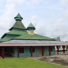
Masjid Jami Koto Pangean 1931
303 kmReviews
Visited this place? Tap the stars to rate it and share your experience / photos with the community! Try now! You can cancel it anytime.
Discover hidden gems everywhere you go!
From secret cafés to breathtaking viewpoints, skip the crowded tourist spots and find places that match your style. Our app makes it easy with voice search, smart filtering, route optimization, and insider tips from travelers worldwide. Download now for the complete mobile experience.

A unique approach to discovering new places❞
— Le Figaro
All the places worth exploring❞
— France Info
A tailor-made excursion in just a few clicks❞
— 20 Minutes