
Walea Kepulauan, district in Tojo Una Una Regency, Central Sulawesi Province, Indonesia
Location: Tojo Una Una
Elevation above the sea: 310 m
GPS coordinates: -0.26556,122.18361
Latest update: March 8, 2025 00:07
Bunaken
348.8 km
Lore Lindu National Park
262.6 km
Kentur Lokon
343 km
Gunung Soputanpatepangan
322.4 km
Kepulauan Togean National Park
24.2 km
Sha'ar Hashamayim Synagogue (Tondano)
350.2 km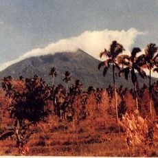
Mount Klabat
370.2 km
Otanaha Fortress
129 km
Mount Mahawu
348.3 km
Palu IV Bridge
267.8 km
Bogani Nani Wartabone National Park
190.3 km
Floating Mosque of Palu
268.3 km
Colo
65 km
Mount Tondano
338.4 km
Ban Hin Kiong Temple
355.1 km
Mount Empung
342 km
Pokekea Megalithic Site
270.7 km
Pantai Indah Modisi
262.6 km
Rumah Katu Marine Park
218.8 km
Sintuwu Maroso Square
202.7 km
Tompaluan
343.1 km
Museum dan Monumen Pendaratan Pesawat Ampibi Catalina
128.8 km
Gereja GMIBM Efrata Modisi
263.1 km
Bulud Kanari
263.6 km
Taman Nasional Hutan Mangrove
262.9 km
Modisi Beach
261.1 km
Gereja GPDI Modisi
263.3 km
Gereja KGPM Modisi
263 kmReviews
Visited this place? Tap the stars to rate it and share your experience / photos with the community! Try now! You can cancel it anytime.
Discover hidden gems everywhere you go!
From secret cafés to breathtaking viewpoints, skip the crowded tourist spots and find places that match your style. Our app makes it easy with voice search, smart filtering, route optimization, and insider tips from travelers worldwide. Download now for the complete mobile experience.

A unique approach to discovering new places❞
— Le Figaro
All the places worth exploring❞
— France Info
A tailor-made excursion in just a few clicks❞
— 20 Minutes