Cachoeira Ararapirá, Wasserfall in Brasilien
Location: Amazonas
Elevation above the sea: 124 m
GPS coordinates: 1.18500,-69.07944
Latest update: March 9, 2025 02:11

Pico da Neblina
344.4 km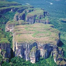
Chiribiquete National Park
418.2 km
Cerro Autana
446.9 km
The Hub on Causeway
256.7 km
Piedra del Cocuy
251.4 km
Pico da Neblina National Park
362 km
Pico 31 de Março
344.6 km
Serranía La Neblina National Park
339.5 km
Piedra del Cocuy Natural Monument
251.4 km
Yapacana National Park
377.2 km
Chiribiquete's rock shelters
410.1 km
Piedra La Tortuga Natural Monument
514.9 km
Duida-Marahuaca National Park
490.7 km
Cerro Duida
453.5 km
Morro dos Seis Lagos Biological Reserve
282.7 km
Central Amazon Ecological Corridor
518.9 km
Forte de São José de Marabitanas
251.4 km
Cué-cué/Marabitanas Indigenous Territory
247.2 km
Auatí-Paraná Extractive Reserve
478.8 km
Cerros Vinilla y Aratitiyope Natural Monument
413 km
Cuao-Sipapo y Moriche Massif Natural Monument
470.5 km
Monumento Natural Cerro Autana
446.9 km
Sipapo Forest Reserve
508.3 km
Sierra Unturan Natural Monument
411 km
Cerros Tapirapecó y Tamacuari Natural Monument
480.5 km
Piedra Pintada Natural Monument
513.6 km
Piedra La Tortuga
514.8 km
Sierra de la Macarena National Nature Park
522.6 kmVisited this place? Tap the stars to rate it and share your experience / photos with the community! Try now! You can cancel it anytime.
Discover hidden gems everywhere you go!
From secret cafés to breathtaking viewpoints, skip the crowded tourist spots and find places that match your style. Our app makes it easy with voice search, smart filtering, route optimization, and insider tips from travelers worldwide. Download now for the complete mobile experience.

A unique approach to discovering new places❞
— Le Figaro
All the places worth exploring❞
— France Info
A tailor-made excursion in just a few clicks❞
— 20 Minutes