
Pfarrhof, pfarrhof, große Hofanlage; Wohnbau, stattliches Satteldachhaus, 1672; ehem. Wirtschaftsgebäude, 18./19. Jahrhundert; - vgl. Ensemble Marktplatz/Marktstraße
Location: Untergriesbach
Address: Passauer Straße 9; Passauer Straße 11
GPS coordinates: 48.57337,13.66513
Latest update: November 14, 2025 08:18
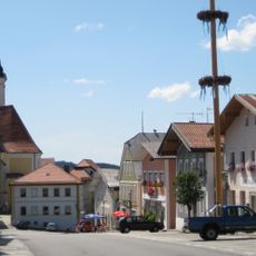
Ensemble Marktplatz/Marktstraße
202 m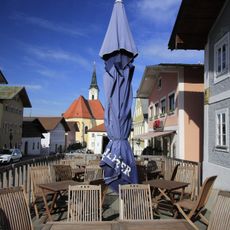
Gasthaus Lanz
175 m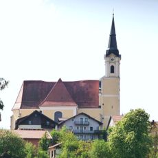
St.Michael in Untergriesbach
45 m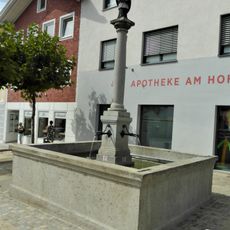
Brunnen mit Figur des hl. Johannes v. Nepomuk
232 m
Portal
109 m
Türgewände
302 m
Katholische Kirche St. Johannes d. T.
568 m
Wohnhaus
201 m
Cultural heritage D-2-7448-0060 in Untergriesbach
44 m
Wohnhaus eines ehem. Bauernhofes
321 m
Drei klassizistische Stuckreliefs
383 m
Wohnhaus
215 m
Wohnhaus
127 m
Wohnhaus
346 m
Wohn- und Geschäftshaus
144 m
Türgewände
366 m
Wohnhaus
464 m
Wohnhaus
166 m
Steinerne Prangersäule
78 m
Ehem. Schule
81 m
Bildstock
197 m
Nebengebäude Passauer Straße 11 in Untergriesbach
25 m
Friedhofskreuz Marktplatz 27 in Untergriesbach
26 m
Friedhofsmauer Marktplatz 27 in Untergriesbach
30 m
Friedhofskreuz Marktplatz 27 in Untergriesbach
29 m
Friedhofskreuz Marktplatz 27 in Untergriesbach
23 m
Sog. Eckersäge
372 m
St. Nepomuk-Statue
233 mReviews
Visited this place? Tap the stars to rate it and share your experience / photos with the community! Try now! You can cancel it anytime.
Discover hidden gems everywhere you go!
From secret cafés to breathtaking viewpoints, skip the crowded tourist spots and find places that match your style. Our app makes it easy with voice search, smart filtering, route optimization, and insider tips from travelers worldwide. Download now for the complete mobile experience.

A unique approach to discovering new places❞
— Le Figaro
All the places worth exploring❞
— France Info
A tailor-made excursion in just a few clicks❞
— 20 Minutes