
Wasserschutzgebiet Welzbachtal, Wasserschutzgebiet im Main-Tauber-Kreis und Landkreis Würzburg
Location: Main-Tauber-Kreis
Location: Würzburg
GPS coordinates: 49.67251,9.66724
Latest update: March 14, 2025 13:40


Steinbruch Werbach
1 km
Wallfahrtskapelle Liebfrauenbrunn
475 m
Lindenberg
1.3 km
Maria-Hilf-Kapelle
1.9 km
Helmental-Kleinleiden
1.4 km
Kreuzweg zur Liebfrauenbrunnkapelle
234 m
Wormental
1.2 km
St. Laurentius
1.3 km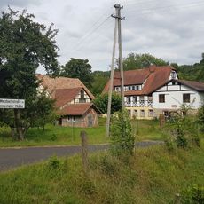
Emmentaler Mühle
2 km
Weidenmühle
1.7 km
Welzmühle
862 m
Blauer Rain
1.2 km
Schneidmühle
648 m
Höhberg
713 m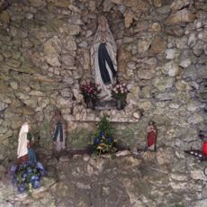
Mariengrotte
1.4 km
Fischzuchtanstalt
497 m
Mühlenbau-Werkstätte
932 m
Sühnekreuz Werbach I
1.8 km
Friedhof Werbachhausen
1.1 km
Naturdenkmal Taubermäander mit Ufergehölz Ried/Langen Grund/Mühlwörth
2.1 km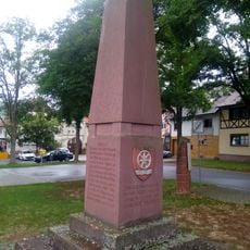
Kriegerdenkmal
2 km
Naturdenkmal Feuchtgebiet Vorderer Beilberg
1.4 km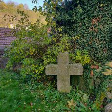
Sühnekreuz Werbach VII
1.4 km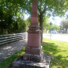
Kriegerdenkmal
2.1 km
Sühnekreuz Werbach III
543 m
Kriegerdenkmal
1.8 km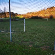
Bolzplatz Werbachhausen
1.5 km
Naturdenkmal Auewald Bildhäusle/Unter der Kapelle
478 mVisited this place? Tap the stars to rate it and share your experience / photos with the community! Try now! You can cancel it anytime.
Discover hidden gems everywhere you go!
From secret cafés to breathtaking viewpoints, skip the crowded tourist spots and find places that match your style. Our app makes it easy with voice search, smart filtering, route optimization, and insider tips from travelers worldwide. Download now for the complete mobile experience.

A unique approach to discovering new places❞
— Le Figaro
All the places worth exploring❞
— France Info
A tailor-made excursion in just a few clicks❞
— 20 Minutes