
Landschaftsschutzgebiet im Landkreis St. Wendel - in der Stadt St. Wendel
Landschaftsschutzgebiet im Landkreis St. Wendel - in der Stadt St. Wendel, protected area in Germany
Location: Sankt Wendel
Inception: 1976
GPS coordinates: 49.50302,7.13407
Latest update: October 31, 2025 03:17
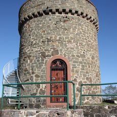
Ruine Liebenburg
1.7 km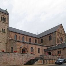
St. Remigius
1.8 km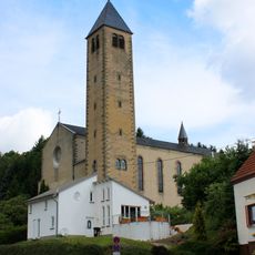
St. Willibrord
2 km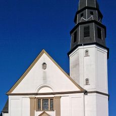
Christkönig-Kirche
2.9 km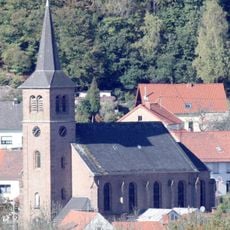
Mariä Himmelfahrt
2.2 km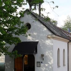
Saint Anne Chapel (Wallesweilerhof)
2.7 km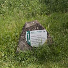
Wendelinus Pilgerweg
3.1 km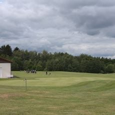
Wendelinus-Golfpark
3.2 km
Komposition mit stereometrischen Elementen
3.2 km
Horizontale Entfaltung
2.7 km
Erinnerung an die Nike von Samothrake
2.8 km
Erdsäule
2.8 km
Basaltbank
2.8 km
Ferkel - Sau
1.9 km
Verschiebung
2.9 km
Hommage à Bunuel
2.6 km
Durchblick in die Landschaft
2.7 km
Großer Fuß
2.8 km
Reveil – Erwachen
94 m
Familie
1.7 km
Bär
2.1 km
Wolkenstein
1.5 km
Informationspfeiler III
3 km
Sculpture, Work of art
3 km
Work of art, sculpture
2.8 km
Work of art
1.2 km
Sculpture, Work of art
3 km
Sculpture, Work of art
2.9 kmReviews
Visited this place? Tap the stars to rate it and share your experience / photos with the community! Try now! You can cancel it anytime.
Discover hidden gems everywhere you go!
From secret cafés to breathtaking viewpoints, skip the crowded tourist spots and find places that match your style. Our app makes it easy with voice search, smart filtering, route optimization, and insider tips from travelers worldwide. Download now for the complete mobile experience.

A unique approach to discovering new places❞
— Le Figaro
All the places worth exploring❞
— France Info
A tailor-made excursion in just a few clicks❞
— 20 Minutes