Chujin-gul, Höhle in Südkorea
Location: Gangwon Province
GPS coordinates: 37.40250,128.42556
Latest update: October 28, 2025 07:12
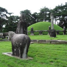
Royal Tombs of the Joseon Dynasty
23 km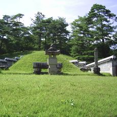
Jangneung
23.2 km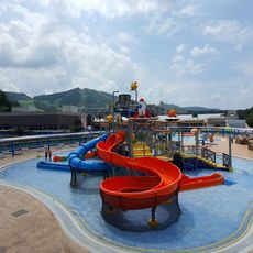
웰리힐리파크 워터플래닛
18.2 km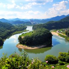
Yeongwol Korean Peninsula Cliffs
21.4 km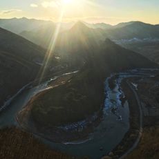
Byeongbangchi
19.1 km
댄싱 도깨비
14.9 km
Scenic viewpoint
11.8 km
요선정
18.7 km
MT. Backduk
11.7 km
백룡동굴생태체험장
19.4 km
백룡동굴
19.4 km
History of Olympic winter games
21.3 km
Dongganghalmiggochseosikji
19 km
젊은달 와이파크
19.9 km
Deulggoch Folk Village
22.4 km
동트는농가 정선군 정선읍 정선로 435
16.4 km
Seondol Cliff
21.9 km
Scenic viewpoint
21 km
Scenic viewpoint
19 km
전망대
21.5 km
서강전망대
21.6 km
Scenic viewpoint
13 km
백석봉전망대
20.3 km
전망대
20.6 km
Scenic viewpoint
23.2 km
단종역사관
23.2 km
엄흥도정여각
23 km
Memorial
21.3 kmReviews
Visited this place? Tap the stars to rate it and share your experience / photos with the community! Try now! You can cancel it anytime.
Discover hidden gems everywhere you go!
From secret cafés to breathtaking viewpoints, skip the crowded tourist spots and find places that match your style. Our app makes it easy with voice search, smart filtering, route optimization, and insider tips from travelers worldwide. Download now for the complete mobile experience.

A unique approach to discovering new places❞
— Le Figaro
All the places worth exploring❞
— France Info
A tailor-made excursion in just a few clicks❞
— 20 Minutes