
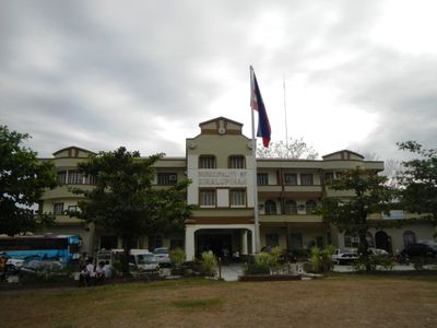
Dinalupihan, municipality of the Philippines in the province of Bataan
Location: Bataan
Inception: 1865
Elevation above the sea: 30 m
Shares border with: Olongapo, Hermosa, Morong, Floridablanca
Website: http://dinalupihan.gov.ph
GPS coordinates: 14.88333,120.46667
Latest update: March 7, 2025 19:46
Abucay Church
19.4 km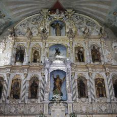
Betis Church
21.6 km
Mount Natib
20.4 km
Bataan National Park
22.9 km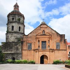
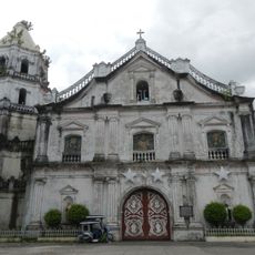
Lubao Church
15.8 km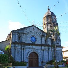
Santa Catalina de Alejandria Church
22.5 km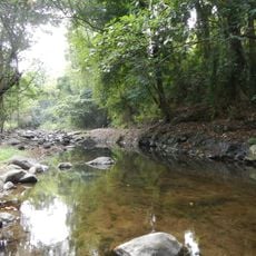
Roosevelt Protected Landscape
20 km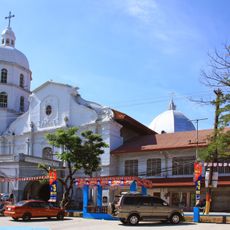
Guagua Church
20.1 km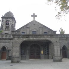
San Jose Obrero Church
12 km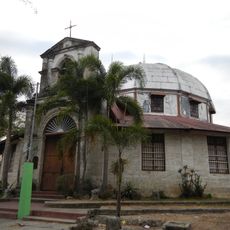
Pio Chapel
19.1 km
Subic Watershed Forest Reserve
23.2 km
Naval Base of Subic Bay historical marker
21 km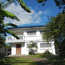
President Diosdado P. Macapagal Library and Museum
15.7 km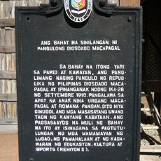
The House Where President Diosdado Macapagal was Born historical marker
15.7 km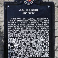
Jose B. Lingad historical marker
15.6 km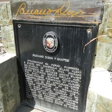
Paciano Dizon y Santos historical marker
22.6 km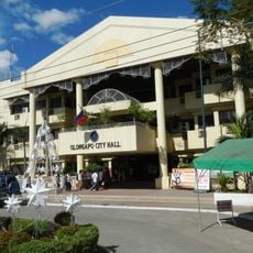
Olongapo City Hall
19.8 km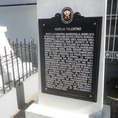
Aurelio Tolentino historical marker
20.1 km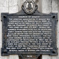
Church of Abucay historical marker
19.5 km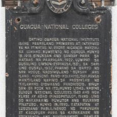
Guagua National Colleges historical marker
20.3 km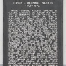
Rufino J. Cardinal Santos historical marker
20.2 km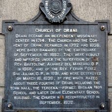
Church of Orani historical marker
11.8 km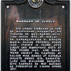
Church of Guagua historical marker
20.2 km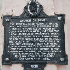
Church of Samal historical marker
15 km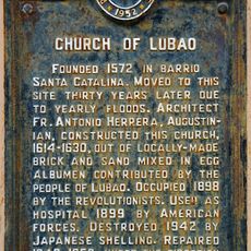
Church of Lubao historical marker
15.8 km
Diosdado P. Macapagal historical marker
15.7 km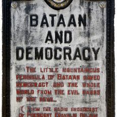
Bataan and Democracy historical marker
3.8 km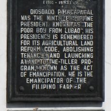
Diosdado P. Macapagal historical marker
15.8 kmReviews
Visited this place? Tap the stars to rate it and share your experience / photos with the community! Try now! You can cancel it anytime.
Discover hidden gems everywhere you go!
From secret cafés to breathtaking viewpoints, skip the crowded tourist spots and find places that match your style. Our app makes it easy with voice search, smart filtering, route optimization, and insider tips from travelers worldwide. Download now for the complete mobile experience.

A unique approach to discovering new places❞
— Le Figaro
All the places worth exploring❞
— France Info
A tailor-made excursion in just a few clicks❞
— 20 Minutes