
Alabat, municipality of the Philippines in the province of Quezon
Location: Quezon
Inception: May 15, 1900
Elevation above the sea: 29 m
Shares border with: Perez, Quezon
Website: http://alabat.gov.ph
GPS coordinates: 14.10226,122.01357
Latest update: March 7, 2025 22:16
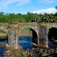
Malagonlong Bridge
44 km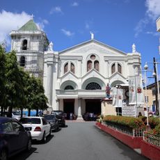
Lucena Cathedral
47.1 km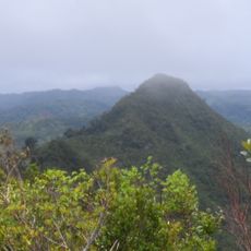
Quezon Protected Landscape
29.5 km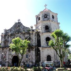
Gumaca Cathedral
22.1 km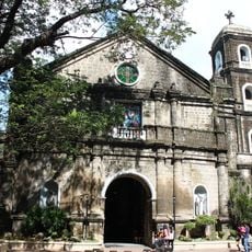
Cainta Church
110.4 km
Nawawalang Paraiso
48.2 km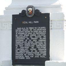
Rizal Hill Park historical marker
32 km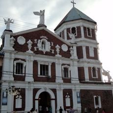
Atimonan Church
15 km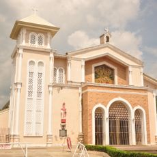
Mauban Church
32.1 km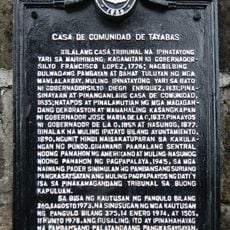
Casa de Comunidad de Tayabas historical marker
46.3 km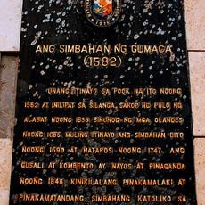
The Church of Gumaca historical marker
22.1 km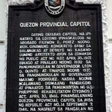
Quezon Provincial Capitol historical marker
47.4 km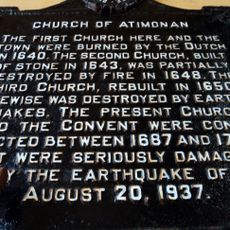
Church of Atimonan historical marker
15 km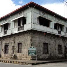
Casa Comunidad of Tayabas
46.3 km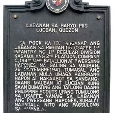
Battle of Barrio Piis historical marker
45.4 km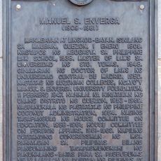
Manuel S. Enverga historical marker
31.8 km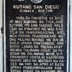
Fort San Diego historical marker
22 km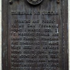
Church of Lucena historical marker
47.1 km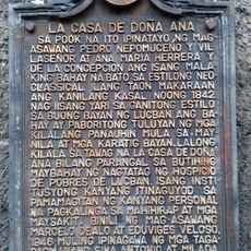
La Casa de Doña Ana historical marker
49.5 km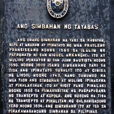
The Church of Tayabas historical marker
46.4 km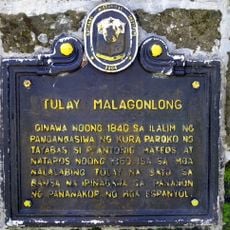
Malagonlong Bridge historical marker
44 km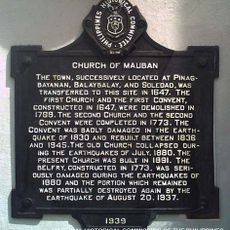
Church of Mauban historical marker
32.1 km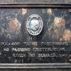
400th Anniversary of the Christianization of the Town of Gumaca historical marker
20.1 km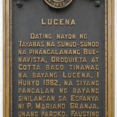
Lucena historical marker
47.1 km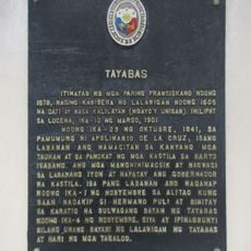
Tayabas historical marker
46.3 km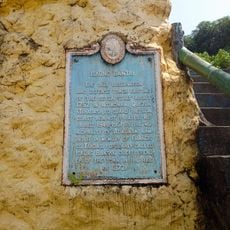
Iskong Bantay historical marker
14.8 km
Horacio de la Costa, S.J. historical marker
32 km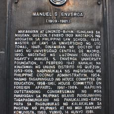
Manuel S. Enverga historical marker
45.7 kmReviews
Visited this place? Tap the stars to rate it and share your experience / photos with the community! Try now! You can cancel it anytime.
Discover hidden gems everywhere you go!
From secret cafés to breathtaking viewpoints, skip the crowded tourist spots and find places that match your style. Our app makes it easy with voice search, smart filtering, route optimization, and insider tips from travelers worldwide. Download now for the complete mobile experience.

A unique approach to discovering new places❞
— Le Figaro
All the places worth exploring❞
— France Info
A tailor-made excursion in just a few clicks❞
— 20 Minutes