
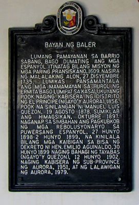
Town of Baler historical marker
Town of Baler historical marker, NHCP historical marker for Baler
Location: Baler
Inception: 2009
Creator: National Historical Commission of the Philippines
Address: San Luis Street
GPS coordinates: 15.75908,121.56290
Latest update: March 7, 2025 23:16

Fort Magsaysay
62.5 km
Minalungao National Park
67.4 km
Cabanatuan American Memorial
62.1 km
Aurora Memorial National Park
26.7 km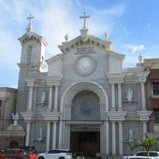
Cabanatuan Cathedral
70.9 km
Pantabangan–Carranglan Watershed Forest Reserve
43.7 km
Mount Guiwan
36.1 km
Casecnan Protected Landscape
32.9 km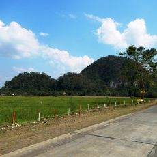
Quirino Protected Landscape
72.7 km
Dinadiawan River Protected Landscape
42.7 km
Baler Church
73 m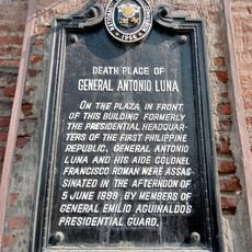
Death Place of General Antonio Luna historical marker
70.9 km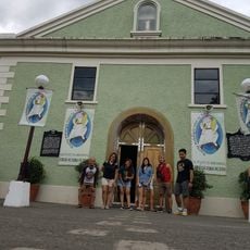
Doña Aurora Aragon-Quezon House
65 m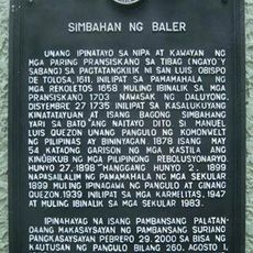
Church of Baler historical marker
70 m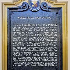
Nueva Ecija High School historical marker
70.2 km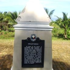
Dikaloyungan historical marker
2.3 km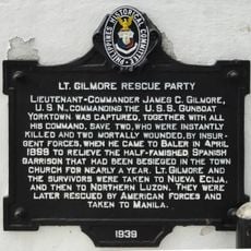
Lt. Gilmore Rescue Party historical marker
38 m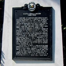
Aurora Aragon Quezon historical marker
54 m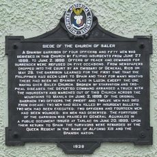
Siege of the Church of Baler historical marker
62 m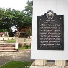
Birthplace of Manuel Luis Quezon historical marker
120 m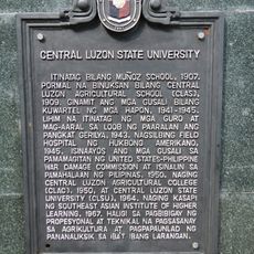
Central Luzon State University historical marker
67.9 km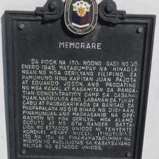
Memorare historical marker (Raid at Cabanatuan)
62.2 km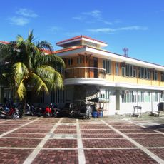
Baler Municipal Hall
18 m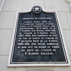
Church of Peñaranda historical marker
75.2 km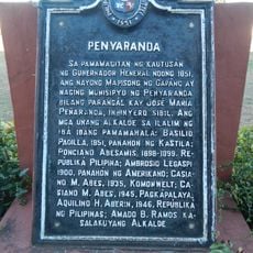
Penyaranda historical marker
73.4 km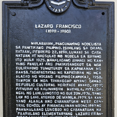
Lazaro Francisco historical marker
71.5 km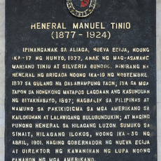
General Manuel Tinio historical marker
72.2 km
Quezon Park
158 mReviews
Visited this place? Tap the stars to rate it and share your experience / photos with the community! Try now! You can cancel it anytime.
Discover hidden gems everywhere you go!
From secret cafés to breathtaking viewpoints, skip the crowded tourist spots and find places that match your style. Our app makes it easy with voice search, smart filtering, route optimization, and insider tips from travelers worldwide. Download now for the complete mobile experience.

A unique approach to discovering new places❞
— Le Figaro
All the places worth exploring❞
— France Info
A tailor-made excursion in just a few clicks❞
— 20 Minutes