
Bildstock, Gemauert, mit Satteldachabschluss, 18./19. Jahrhundert
Location: Geisenhausen
Address: Stadelwiese. Östlich des Weilers
GPS coordinates: 48.46665,12.22381
Latest update: August 9, 2025 07:43

Sankt Martin (Geisenhausen)
2.7 km
St. Ulrich
3.6 km
St. Maria (Götzdorf)
3 km
St. Kastulus
4 km
Katholische Kirche Mariä Aufnahme in den Himmel mit Mauer
2.1 km
Katholische Kirche St. Theobald
2.8 km
Kreuzkapelle St. Theobald
2.8 km
Kapelle
4 km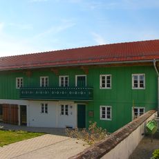
Ehemaliges Bauernhaus
3.6 km
Marktplatz 2
2.6 km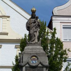
Kriegerdenkmal
2.6 km
Wohnhaus
2.8 km
Wohnhaus
2.7 km
Hauptstraße 7
2.6 km
Kleine Vils
2.4 km
Ehemaliges Bauernhaus
3.3 km
Ensemble Hauptstraße/Marktplatz
2.6 km
Landshuter Straße 2
2.6 km
Haus Nr. 8 -
2.9 km
Bildstock Maria, Hilfe der Christen
2.3 km
Wohnstallhaus eines ehemaligen Dreiseithofs
3 km
Kleinhaus
2.8 km
Marktplatz 9
2.6 km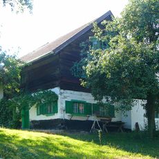
Wohnstallhaus und Backhaus
3.4 km
Stadel
3.1 km
Wohnstallhaus eines Vierseithofs
3.9 km
Wohnhaus
2.6 km
Bahnhofstraße 5
2.5 kmReviews
Visited this place? Tap the stars to rate it and share your experience / photos with the community! Try now! You can cancel it anytime.
Discover hidden gems everywhere you go!
From secret cafés to breathtaking viewpoints, skip the crowded tourist spots and find places that match your style. Our app makes it easy with voice search, smart filtering, route optimization, and insider tips from travelers worldwide. Download now for the complete mobile experience.

A unique approach to discovering new places❞
— Le Figaro
All the places worth exploring❞
— France Info
A tailor-made excursion in just a few clicks❞
— 20 Minutes