Reiseter - Dravladalsvatnet, rock art in Ullensvang, Vestland, Norway
Location: Ullensvang Municipality
GPS coordinates: 60.25702,6.44884
Latest update: October 29, 2025 13:04
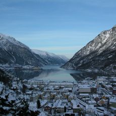
Sørfjorden
8.3 km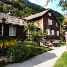
Agatunet
9.8 km
Nordre Folgefonna
6.3 km
Aga - Gropstein (Klokkesteinen)
10.4 km
Aga - Fetts fk. 13, Tveitesteinen (Aga II )
9.6 km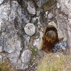
Handegard - Kleberbrot
6.3 km
Tveit - Fetts fk. 3
10.5 km
Øvre Børve - Fetts fk. 19, Kråkeflot (Børve XV)
10.2 km
Øvre Børve - Børve XXXIV (Innitun (Olintuns))
10.1 km
Aga - Gropstein (Aga V og VI)
9.7 km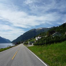
Strada panoramica Hardanger
6.2 km
Børve - Fetts fk. 16, Storesteinen (Børve V)
10.3 km
Handegard - Fetts fk. 1, Vassete
6.4 km
Reiseter - Fetts fk. 3, Haugen
5.8 km
Aga - Fetts fk. 12, Vikane (Aga I )
10.4 km
Nedre Børve - Fetts fk. 13, Skori/Kleiva (Børve I)
9.8 km
Aga - Aga VII (Brattestien)
9.8 km
Aga IX og X Jacobsløa
9.8 km
Aga XI - Opeskor
10 km
Hovland - Fetts NB (Hovland V)
9.6 km
Aga - Gropstein (Aga IV)
9.4 km
Måkestad - Fetts fk. 5 (Måkestad I)
5.9 km
Rogdaberg I - Lykklabakkjen (Vedaheldren)
8.3 km
Øvre Børve - Børve XXXV (Kråkeflot)
10.4 km
Børve - Fetts fk. 15, (Børve IV (Felt A-D))
10.1 km
Aga - Fetts NB. 4 (Aga III)
9.7 km
Børve - Fetts fk. 17, Innitun (Børve VI)
10.1 km
Scenic viewpoint
10.2 kmReviews
Visited this place? Tap the stars to rate it and share your experience / photos with the community! Try now! You can cancel it anytime.
Discover hidden gems everywhere you go!
From secret cafés to breathtaking viewpoints, skip the crowded tourist spots and find places that match your style. Our app makes it easy with voice search, smart filtering, route optimization, and insider tips from travelers worldwide. Download now for the complete mobile experience.

A unique approach to discovering new places❞
— Le Figaro
All the places worth exploring❞
— France Info
A tailor-made excursion in just a few clicks❞
— 20 Minutes