LEIREN
Location: Aure Municipality
GPS coordinates: 63.20059,7.96215
Latest update: November 11, 2025 18:21
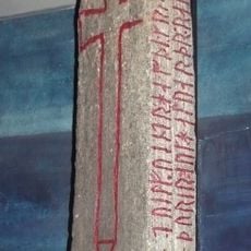
Kulisteinen
12.4 km
Trollstua
5.4 km
Soleimsundbrua
10.1 km
Sålåsundet
10.7 km
Gløsvågen
10.4 km
Sør-Smøla
12.4 km
Hagahammaren
7.5 km
Svarthammaren
4.2 km
Bjønnaklova
9.8 km
Sandvikmyrane
8 km
Tindan
5.8 km
Ytterseter I
10.8 km
Malivika.
11 km
Skarvhammaren
9.1 km
Rosvoll prestegard
12.2 km
HALS
12.4 km
Nordkolvika
9.7 km
Torpedobatteri Nordlandet
9.2 km
Nordlandet kystfort
10.8 km
Rosvoll prestegard
12.2 km
Kristiansund og Omegn golfklubb
11.1 km
Minnestein over Hans Idar Lossius
11.9 km
Rosvoll prestegard
12.2 km
Scenic viewpoint
11.1 km
Scenic viewpoint
10.7 km
Scenic viewpoint
12.2 km
Cannon
11.7 km
Cannon
11.6 kmReviews
Visited this place? Tap the stars to rate it and share your experience / photos with the community! Try now! You can cancel it anytime.
Discover hidden gems everywhere you go!
From secret cafés to breathtaking viewpoints, skip the crowded tourist spots and find places that match your style. Our app makes it easy with voice search, smart filtering, route optimization, and insider tips from travelers worldwide. Download now for the complete mobile experience.

A unique approach to discovering new places❞
— Le Figaro
All the places worth exploring❞
— France Info
A tailor-made excursion in just a few clicks❞
— 20 Minutes