Rossavik øvre
Location: Sandnes Municipality
GPS coordinates: 58.88042,6.13748
Latest update: November 15, 2025 00:28
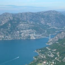
Lysefjord Bridge
5.5 km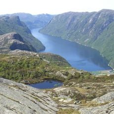
Frafjorden
4.5 km
Landa
1.9 km
Lauvvik
5 km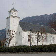
Forsand Church
3.2 km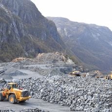
Norsk Stein Dirdal
5.1 km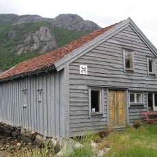
Sjøhuset i Bergevik
3.6 km
Olsberga
4.5 km
Foreknuten
3.5 km
Barlongberga
5.4 km
Yleskog
5.6 km
KJØDLINGVOLLEN
5.3 km
Osen
5.4 km
VINDOLDÅ
759 m
Rolighedå
5.4 km
HEIÅ
358 m
Borghammaren
3.7 km
BREIVIKSKARET
628 m
Fossan
3.6 km
TOREBAKKJEN
2.5 km
STEINBERG
2.1 km
Fossan
1.8 km
Seter
5.5 km
Scenic viewpoint
4.7 km
Mulen
5.2 km
Scenic viewpoint
5.5 km
Waterfall
3 km
Fossen
3.9 kmReviews
Visited this place? Tap the stars to rate it and share your experience / photos with the community! Try now! You can cancel it anytime.
Discover hidden gems everywhere you go!
From secret cafés to breathtaking viewpoints, skip the crowded tourist spots and find places that match your style. Our app makes it easy with voice search, smart filtering, route optimization, and insider tips from travelers worldwide. Download now for the complete mobile experience.

A unique approach to discovering new places❞
— Le Figaro
All the places worth exploring❞
— France Info
A tailor-made excursion in just a few clicks❞
— 20 Minutes