Habo 76:1, stenkrets i Västergötland
Location: Habo Municipality
GPS coordinates: 57.91701,14.06701
Latest update: November 15, 2025 14:37
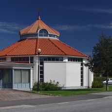
Saint John's Church
1.4 km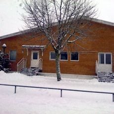
Salem Church in Habo
589 m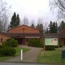
Habo Mission Covenant Church
1.3 km
Hökesån -Habo
763 m
Dykärr 1:3 och 1:4
2.5 km
Habo 63:2
2.1 km
Habo 65:1
2.5 km
Habo 77:1
1.9 km
Skogen
2.5 km
Habo 200:1
2.5 km
Habo 204:1
2.1 km
Habo 47:1
1.2 km
Habo 63:3
2.1 km
Habo 204:3
1.9 km
Habo 64:1
2.2 km
Habo 204:2
2 km
Habo 202:1
2.3 km
Habo 203:1
2.1 km
Habo 80:1
2.1 km
Habo 62:1
2 km
Habo 47:2
1.2 km
Habo 201:1
2.3 km
Habo 199:1
2.4 km
Habo 325
2.3 km
Habo 198:1
2.1 km
Habo 63:1
2.1 km
Habo 44:1
1.8 km
Habo 194:1
1.1 kmReviews
Visited this place? Tap the stars to rate it and share your experience / photos with the community! Try now! You can cancel it anytime.
Discover hidden gems everywhere you go!
From secret cafés to breathtaking viewpoints, skip the crowded tourist spots and find places that match your style. Our app makes it easy with voice search, smart filtering, route optimization, and insider tips from travelers worldwide. Download now for the complete mobile experience.

A unique approach to discovering new places❞
— Le Figaro
All the places worth exploring❞
— France Info
A tailor-made excursion in just a few clicks❞
— 20 Minutes