Sönnerbodarna, fäbod i Jämtland (Borgvattnet 160:1)
Location: Ragunda Municipality
GPS coordinates: 63.45627,15.71952
Latest update: November 15, 2025 12:47
Hammerdals kommun
22.1 km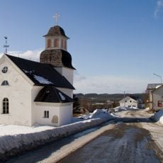
Borgvattnets kyrka
6.5 km
Ammerån
14.7 km
Edeforsen
16.3 km
Vackermyren
18.3 km
Helvetesmyrkälen
25.1 km
Hagamarken
16.9 km
Länglingsån
17.7 km
Mörtsjöberget
6.4 km
Källberget-Storberget
14.7 km
Björntjärnlokarna
23.6 km
Eldsjöbäcken
26.4 km
Tvärmyran
22.1 km
Skallflohålen
12.5 km
Långstrandberget
20 km
Skarpåskälabodarna
26.1 km
Storflohöjden
26.1 km
Finnbodarna
15.4 km
Harrsjöbodarna
23 km
Markusgården
7.4 km
Hammerdal 203:1
15.5 km
Nybodarna
8.8 km
Kallsnäs
23.3 km
Kallsnäs
23.3 km
Gammelbodarna
25.7 km
Borgflobodarna
15.9 km
Backe kägelbana
26.3 km
Aspnäset
8.3 kmReviews
Visited this place? Tap the stars to rate it and share your experience / photos with the community! Try now! You can cancel it anytime.
Discover hidden gems everywhere you go!
From secret cafés to breathtaking viewpoints, skip the crowded tourist spots and find places that match your style. Our app makes it easy with voice search, smart filtering, route optimization, and insider tips from travelers worldwide. Download now for the complete mobile experience.

A unique approach to discovering new places❞
— Le Figaro
All the places worth exploring❞
— France Info
A tailor-made excursion in just a few clicks❞
— 20 Minutes