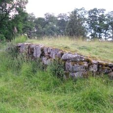
Södra Ving 28:1, stenkrets i Västergötland
Location: Ulricehamn Municipality
GPS coordinates: 57.85001,13.29562
Latest update: November 21, 2025 20:46
Vädersholm
1.3 km
Södra Ving 142:1
889 m
Södra Ving 148:4
1.2 km
Södra Ving 123:1
653 m
Kungshögen
1.2 km
Södra Ving 22:1
1.1 km
Södra Ving 23:2
1 km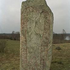
Västergötlands runinskrifter 169
450 m
Södra Ving 230:6
400 m
Södra Ving 148:2
1.2 km
Södra Ving 234:1
753 m
Skogslund
803 m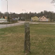
Västergötlands runinskrifter 168
1.2 km
Bruserör
1.2 km
Södra Ving 230:1
412 m
Svedjorna
551 m
Kungshögen
1.2 km
Granelund
899 m
Södra Ving 233:1
451 m
Solbacken
1.3 km
Södra Ving 23:3
1 km
Södra Ving 124:1
659 m
Södra Ving 229:1
466 m
Södra Ving 23:1
1 km
Solbacken
1.3 km
Svedjorna
424 m
Kungshögen
1.2 km
Kungshögen
1.2 kmReviews
Visited this place? Tap the stars to rate it and share your experience / photos with the community! Try now! You can cancel it anytime.
Discover hidden gems everywhere you go!
From secret cafés to breathtaking viewpoints, skip the crowded tourist spots and find places that match your style. Our app makes it easy with voice search, smart filtering, route optimization, and insider tips from travelers worldwide. Download now for the complete mobile experience.

A unique approach to discovering new places❞
— Le Figaro
All the places worth exploring❞
— France Info
A tailor-made excursion in just a few clicks❞
— 20 Minutes