
Part of a Roman road 250m south of Stubb Hill Farm
Part of a Roman road 250m south of Stubb Hill Farm, archaeological site in Stedham with Iping, Chichester, England, UK
Location: Stedham with Iping
GPS coordinates: 51.01100,-0.79116
Latest update: November 8, 2025 13:58
Chithurst Buddhist Monastery
1.1 km
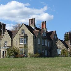
Wispers
1.2 km
Church of St Mary
1.3 km
Chithurst Church
1.3 km
Iping House
1.4 km
Chithurst Bridge
1.3 km
Hammer Cottage
737 m
Iping Bridge
1.4 km
Abbey House
1.3 km
Ash House
750 m
Moor House Farmhouse
755 m
Woolhouse Farmhouse
1.4 km
Malt House
1.1 km
Barn At Gatehouse Farm To The South East Of The Farmhouse
1.7 km
Whites Farmhouse
1.8 km
Hammer Wood hillfort
355 m
Stubbs Farmhouse
700 m
Barn At Crouchhouse Farm To The North West Of The Farmhouse
1.2 km
Stubbs Hill Paddock
178 m
Crouchhouse Farmhouse
1.2 km
Hammerwood House, Iping
899 m
Old Kingsham Farmhouse
1.4 km
Tentworth
665 m
Well House
373 m
Robins Cottage
967 m
Gatehouse Farmhouse
1.7 km
Knapp Farm Knapp House
1.1 km
Chithurst Farmhouse
1.3 kmReviews
Visited this place? Tap the stars to rate it and share your experience / photos with the community! Try now! You can cancel it anytime.
Discover hidden gems everywhere you go!
From secret cafés to breathtaking viewpoints, skip the crowded tourist spots and find places that match your style. Our app makes it easy with voice search, smart filtering, route optimization, and insider tips from travelers worldwide. Download now for the complete mobile experience.

A unique approach to discovering new places❞
— Le Figaro
All the places worth exploring❞
— France Info
A tailor-made excursion in just a few clicks❞
— 20 Minutes