
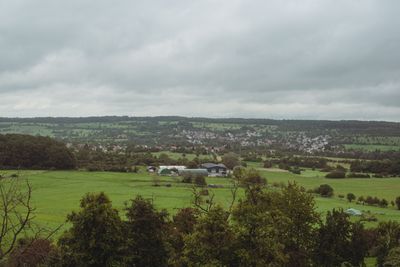
Erfweiler-Ehlingen, human settlement in Germany
Location: Mandelbachtal
Elevation above the sea: 289 m
GPS coordinates: 49.19560,7.18611
Latest update: November 23, 2025 20:51
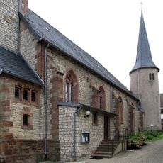
St. Mauritius
120 m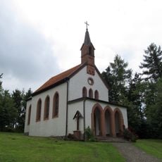
Josefskapelle
554 m
Hölschberg
1 km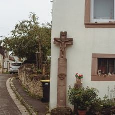
Wegkreuz Auf dem Hüwel 15
631 m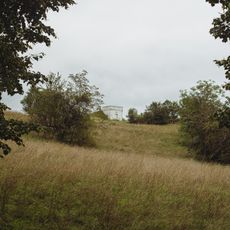
Hochbehälter Hölschberg
951 m
Wayside cross
838 m
Wayside cross
169 m
Christianity, wayside shrine
353 m
Wayside cross
672 m
Memorial, war memorial
383 m
Langenbahn
823 m
Bergleute Denkmal
427 m
Wayside cross
664 m
Wayside cross, Christianity
987 m
Scenic viewpoint
675 m
Langenbahn
257 m
Wayside cross
961 m
Dincher
407 m
Wayside cross, Christianity
630 m
Wayside cross, Christianity
528 m
Wayside cross, Christianity
379 m
Wayside cross
926 m
Wayside shrine
771 m
Wayside shrine, Christianity
498 m
Wayside shrine, Christianity
521 m
Christianity, wayside shrine
402 m
Wayside shrine, Christianity
418 m
Christianity, wayside shrine
474 mReviews
Visited this place? Tap the stars to rate it and share your experience / photos with the community! Try now! You can cancel it anytime.
Discover hidden gems everywhere you go!
From secret cafés to breathtaking viewpoints, skip the crowded tourist spots and find places that match your style. Our app makes it easy with voice search, smart filtering, route optimization, and insider tips from travelers worldwide. Download now for the complete mobile experience.

A unique approach to discovering new places❞
— Le Figaro
All the places worth exploring❞
— France Info
A tailor-made excursion in just a few clicks❞
— 20 Minutes