
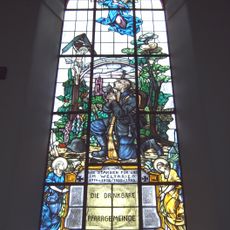
Bildstock, gemauert, 18. Jahrhundert
Location: Kröning
Address: Hartlsöd, nähe Krüglmühle, an der Straße zwischen Neißl und Hölzlgrub
GPS coordinates: 48.49075,12.34633
Latest update: November 22, 2025 20:30
Pfarrkirche Maria Immaculata
884 m
Schloss Lichtenhaag
1.9 km
Schloss Seyboldsdorf
1 km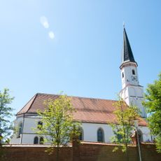
St. Johann
1.1 km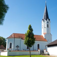
Katholische Kirche Stephanus mit Mauer
1.4 km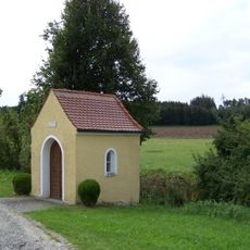
Kapelle
1.6 km
Hofbrunnen Am Rain 3 in Kröning
917 m
Cultural heritage D-2-7540-0220 in Vilsbiburg
1 km
Cultural heritage D-2-7540-0028 in Kröning
534 m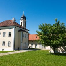
Pfarrhof mit Stadel, Backhaus und Brunnen
917 m
Cultural heritage D-2-7540-0141 in Kröning
805 m
Cultural heritage D-2-7540-0219 in Vilsbiburg
1.1 km
Cultural heritage D-2-7440-0122 in Kröning
1.5 km
Lourdeskapelle Klosterweg 4 in Vilsbiburg
1.1 km
Wohnstallhaus
661 m
Wohnstallhaus
1.6 km
Toranlage Am Rain 3 in Kröning
907 m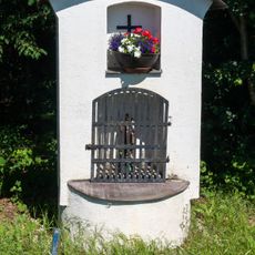
Bildstock
21 m
Remise Am Rain 3 in Kröning
914 m
Cultural heritage D-2-7540-0163 in Gerzen
1.9 km
Cultural heritage D-2-7540-0027 in Geisenhausen
582 m
Backhaus Am Rain 3 in Kröning
936 m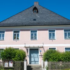
Pfarrhof
1.1 km
Friedhofsmauer Helmsdorf 39 in Geisenhausen
1.4 km
Friedhofsmauer Klosterweg 4 in Vilsbiburg
1.1 km
Wayside cross
1.4 km
Wayside cross
1 km
Wayside cross
704 mReviews
Visited this place? Tap the stars to rate it and share your experience / photos with the community! Try now! You can cancel it anytime.
Discover hidden gems everywhere you go!
From secret cafés to breathtaking viewpoints, skip the crowded tourist spots and find places that match your style. Our app makes it easy with voice search, smart filtering, route optimization, and insider tips from travelers worldwide. Download now for the complete mobile experience.

A unique approach to discovering new places❞
— Le Figaro
All the places worth exploring❞
— France Info
A tailor-made excursion in just a few clicks❞
— 20 Minutes