El Cotero, triangulation station in San Pedro del Romeral, Spain
Location: San Pedro del Romeral
Elevation above the sea: 1,500.227 m
Height: 1.2 m
GPS coordinates: 43.08565,-3.75704
Latest update: November 20, 2025 12:02
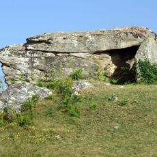
Dolmen de Busnela
7.3 km
Waterfall Guarguero
7.5 km
La mujer desnuda
7.4 km
Castaño de San Julián
7.4 km
Castaño del Arroyo
6.3 km
Pirucal de la Bolera
7.4 km
Gran Haya de La Engaña
2.9 km
Scenic viewpoint
7.3 km
El Ventanón
7.6 km
Scenic viewpoint
7.5 km
Mirador Alto de Estacas
5 km
Scenic viewpoint
5.7 km
Scenic viewpoint
7.5 km
Wayside cross, Catholic church building
7.4 km
Catholic church building, wayside cross
7.4 km
Túmulo de Ahedo
7.1 km
Wayside shrine
6 km
Wayside shrine
5.9 km
Palacio Condes de La Revilla (desaparecido)
7.2 km
Catholic church building, wayside cross
4.9 km
Wayside shrine
7.3 km
Cascada del Pardo
5.7 km
Cascada Salceda
7.5 km
Cascada de la Hoya
7.7 km
Cascada de la Osera
2.8 km
Waterfall
5.3 km
Waterfall
5.4 km
Waterfall
5.5 kmReviews
Visited this place? Tap the stars to rate it and share your experience / photos with the community! Try now! You can cancel it anytime.
Discover hidden gems everywhere you go!
From secret cafés to breathtaking viewpoints, skip the crowded tourist spots and find places that match your style. Our app makes it easy with voice search, smart filtering, route optimization, and insider tips from travelers worldwide. Download now for the complete mobile experience.

A unique approach to discovering new places❞
— Le Figaro
All the places worth exploring❞
— France Info
A tailor-made excursion in just a few clicks❞
— 20 Minutes