Dowdeswell Reservoir, reservoir in Gloucestershire, England, UK
Location: Dowdeswell
Elevation above the sea: 115 m
GPS coordinates: 51.87610,-2.01750
Latest update: November 24, 2025 09:33
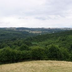
Lineover Wood
990 m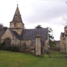
Church of Saint Michael and All Saints
1.2 km
Gates, Gate Piers, Railings And Wall, Dowdeswell Lodge
880 m
The Eight Gabled House
1.2 km
Lineover long barrow, 530m south west of Castle Barn Farm
1.2 km
Gates, Railings And Wall Forming Boundary To Churchyard
1.2 km
Dowdeswell Lodge
892 m
Gatehouse With First Floor Dovecot And Attached Open Fronted Store, The Tithe Barn, Lower Dowdeswell
1.2 km
Woodbank House
597 m
Hillfort 320m north east of Castle Barn Farm
1.1 km
Gates And Gate Piers Forming North Entrance To Dowdeswell Court
1.3 km
The Tithe Barn
1.2 km
The Old Rectory
1.1 km
Home Farm
1.2 km
Gate Piers And Wall In Front Of The Manor House
1.7 km
Dowdeswell House
1.1 km
Rossley Manor
375 m
William Rogers, Thomas Rogers And Anthony Lawrence Monuments In The Churchyard Of Church Of St Michael In Row East Of Path To South Porch
1.2 km
Dowdeswell Court
1.3 km
The Rookery
1.6 km
Coxhorne
1 km
Old Coxhorne
996 m
Whitehorne
849 m
Balcarras Court
1.6 km
The Old Barn
1.7 km
Rossley Gate
318 m
Nathaniel Okey Monument In The Churchyard Of The Church Of St Michael Right Of And Attached To South Porch
1.2 km
The Headmasters House, Dowdeswell Court
1.3 kmReviews
Visited this place? Tap the stars to rate it and share your experience / photos with the community! Try now! You can cancel it anytime.
Discover hidden gems everywhere you go!
From secret cafés to breathtaking viewpoints, skip the crowded tourist spots and find places that match your style. Our app makes it easy with voice search, smart filtering, route optimization, and insider tips from travelers worldwide. Download now for the complete mobile experience.

A unique approach to discovering new places❞
— Le Figaro
All the places worth exploring❞
— France Info
A tailor-made excursion in just a few clicks❞
— 20 Minutes